

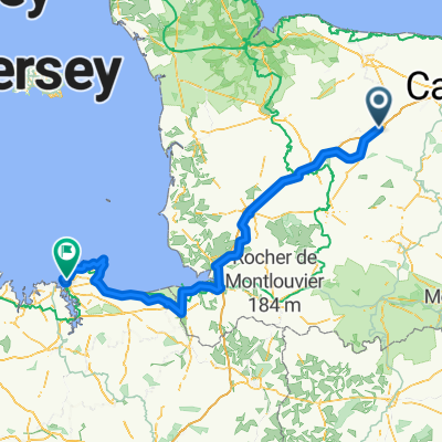
France - Whole Trip
A cycling route starting in Villers-Bocage, Normandy, France.
Overview
About this route
- -:--
- Duration
- 292.6 km
- Distance
- 811 m
- Ascent
- 782 m
- Descent
- ---
- Avg. speed
- ---
- Avg. speed

Route quality
Waytypes & surfaces along the route
Waytypes
Quiet road
129.7 km
(44 %)
Path
53.4 km
(18 %)
Surfaces
Paved
90.3 km
(31 %)
Unpaved
27.8 km
(9 %)
Asphalt
87.5 km
(30 %)
Sand
7.9 km
(3 %)
Continue with Bikemap
Use, edit, or download this cycling route
You would like to ride France - Whole Trip or customize it for your own trip? Here is what you can do with this Bikemap route:
Free features
- Save this route as favorite or in collections
- Copy & plan your own version of this route
- Sync your route with Garmin or Wahoo
Premium features
Free trial for 3 days, or one-time payment. More about Bikemap Premium.
- Navigate this route on iOS & Android
- Export a GPX / KML file of this route
- Create your custom printout (try it for free)
- Download this route for offline navigation
Discover more Premium features.
Get Bikemap PremiumFrom our community
Other popular routes starting in Villers-Bocage
 cabourg
- Distance
- 0.3 km
- Ascent
- 5 m
- Descent
- 0 m
- Location
- Villers-Bocage, Normandy, France
 65 Impasse Beltot, Saint-Germain-d'Ectot à 2 Rue Edmond Bellin, Lion-sur-Mer
- Distance
- 39.7 km
- Ascent
- 184 m
- Descent
- 278 m
- Location
- Villers-Bocage, Normandy, France
 arrivée à Villers-Bocage
- Distance
- 2.8 km
- Ascent
- 40 m
- Descent
- 24 m
- Location
- Villers-Bocage, Normandy, France
 France - Whole Trip
- Distance
- 292.6 km
- Ascent
- 811 m
- Descent
- 782 m
- Location
- Villers-Bocage, Normandy, France
 Villers-Bocage - St.Malo
- Distance
- 173.8 km
- Ascent
- 691 m
- Descent
- 820 m
- Location
- Villers-Bocage, Normandy, France
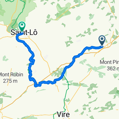 Bocage- Saint Lo
- Distance
- 68.6 km
- Ascent
- 419 m
- Descent
- 532 m
- Location
- Villers-Bocage, Normandy, France
 Normandy Stage 2
- Distance
- 44.8 km
- Ascent
- 470 m
- Descent
- 442 m
- Location
- Villers-Bocage, Normandy, France
 Aunay - MontPinçon - Ondefontaine
- Distance
- 37.9 km
- Ascent
- 525 m
- Descent
- 529 m
- Location
- Villers-Bocage, Normandy, France
Open it in the app