

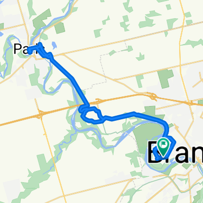
Brantford to Hamilton, ON Rail Trail
A cycling route starting in Brantford, Ontario, Canada.
Overview
About this route
This trail returns you to the GO Aldershot train station.
The Caledonia - Hamilton rail trail isn't found on most railtrail maps, because it's unfinished at the Caledonia end. However, it still beats most sideroads. Note the detours required to get around the LMA Parkway interchange. Thanks, Hamilton!
- -:--
- Duration
- 75.7 km
- Distance
- 145 m
- Ascent
- 242 m
- Descent
- ---
- Avg. speed
- 224 m
- Avg. speed
Route quality
Waytypes & surfaces along the route
Waytypes
Cycleway
29.7 km
(39 %)
Busy road
24.3 km
(32 %)
Surfaces
Paved
57 km
(75 %)
Unpaved
10.9 km
(14 %)
Asphalt
52.1 km
(69 %)
Unpaved (undefined)
9.6 km
(13 %)
Continue with Bikemap
Use, edit, or download this cycling route
You would like to ride Brantford to Hamilton, ON Rail Trail or customize it for your own trip? Here is what you can do with this Bikemap route:
Free features
- Save this route as favorite or in collections
- Copy & plan your own version of this route
- Sync your route with Garmin or Wahoo
Premium features
Free trial for 3 days, or one-time payment. More about Bikemap Premium.
- Navigate this route on iOS & Android
- Export a GPX / KML file of this route
- Create your custom printout (try it for free)
- Download this route for offline navigation
Discover more Premium features.
Get Bikemap PremiumFrom our community
Other popular routes starting in Brantford
 Brantford to Webster Falls
- Distance
- 35.9 km
- Ascent
- 220 m
- Descent
- 234 m
- Location
- Brantford, Ontario, Canada
 Grant's Crossing Trail
- Distance
- 29.9 km
- Ascent
- 288 m
- Descent
- 288 m
- Location
- Brantford, Ontario, Canada
 RAIL TRAIL. Arthur Street 3, Brantford to Hamilton - Brantford Rail Trail
- Distance
- 20.3 km
- Ascent
- 63 m
- Descent
- 49 m
- Location
- Brantford, Ontario, Canada
 Cannonball 355 - Brantford w/Niagara River
- Distance
- 368.7 km
- Ascent
- 1,313 m
- Descent
- 1,314 m
- Location
- Brantford, Ontario, Canada
 12 Passmore Crt, Brantford to 14 Passmore Crt, Brantford
- Distance
- 17.9 km
- Ascent
- 72 m
- Descent
- 75 m
- Location
- Brantford, Ontario, Canada
 Cracking ride in Brantford
- Distance
- 10.9 km
- Ascent
- 441 m
- Descent
- 444 m
- Location
- Brantford, Ontario, Canada
 Weight Loss Route
- Distance
- 22.3 km
- Ascent
- 73 m
- Descent
- 71 m
- Location
- Brantford, Ontario, Canada
 Road/Gravel Route for All
- Distance
- 38.2 km
- Ascent
- 107 m
- Descent
- 108 m
- Location
- Brantford, Ontario, Canada
Open it in the app