

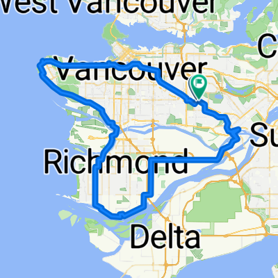
Richmond loop from Central Park
A cycling route starting in Burnaby, British Columbia, Canada.
Overview
About this route
Option to leave out Iona. The map is not all of my preferred route/streets but gives an idea.
- -:--
- Duration
- 72.4 km
- Distance
- 163 m
- Ascent
- 142 m
- Descent
- ---
- Avg. speed
- ---
- Avg. speed
Route quality
Waytypes & surfaces along the route
Waytypes
Cycleway
29.3 km
(40 %)
Quiet road
22.5 km
(31 %)
Surfaces
Paved
58.9 km
(81 %)
Unpaved
3.9 km
(5 %)
Asphalt
49.2 km
(68 %)
Paved (undefined)
6.2 km
(9 %)
Continue with Bikemap
Use, edit, or download this cycling route
You would like to ride Richmond loop from Central Park or customize it for your own trip? Here is what you can do with this Bikemap route:
Free features
- Save this route as favorite or in collections
- Copy & plan your own version of this route
- Sync your route with Garmin or Wahoo
Premium features
Free trial for 3 days, or one-time payment. More about Bikemap Premium.
- Navigate this route on iOS & Android
- Export a GPX / KML file of this route
- Create your custom printout (try it for free)
- Download this route for offline navigation
Discover more Premium features.
Get Bikemap PremiumFrom our community
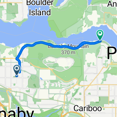
Other popular routes starting in Burnaby
 East Van Breweries
- Distance
- 23.7 km
- Ascent
- 107 m
- Descent
- 107 m
- Location
- Burnaby, British Columbia, Canada
 Route in Burnaby
- Distance
- 31.5 km
- Ascent
- 438 m
- Descent
- 436 m
- Location
- Burnaby, British Columbia, Canada
 burnaby ubc Richmond loop
- Distance
- 82.9 km
- Ascent
- 607 m
- Descent
- 607 m
- Location
- Burnaby, British Columbia, Canada
 Route to Metropolis at Metrotown
- Distance
- 3.7 km
- Ascent
- 113 m
- Descent
- 14 m
- Location
- Burnaby, British Columbia, Canada
 4730 Lougheed Hwy, Burnaby to 21298 36 Ave, Langley
- Distance
- 41.2 km
- Ascent
- 357 m
- Descent
- 340 m
- Location
- Burnaby, British Columbia, Canada
 Burnaby Barnet
- Distance
- 10.5 km
- Ascent
- 86 m
- Descent
- 150 m
- Location
- Burnaby, British Columbia, Canada
 SFU, TCT North Road, Stoney Creek
- Distance
- 17.6 km
- Ascent
- 393 m
- Descent
- 384 m
- Location
- Burnaby, British Columbia, Canada
 BC Pky, Burnaby to Southwynde Ave, Burnaby
- Distance
- 25.1 km
- Ascent
- 307 m
- Descent
- 378 m
- Location
- Burnaby, British Columbia, Canada
Open it in the app