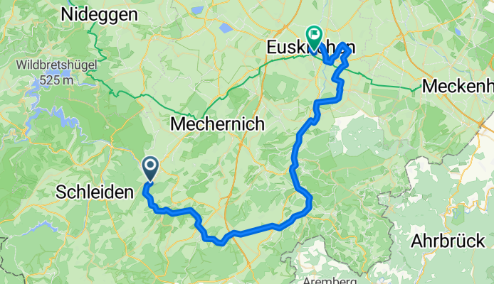
Cycling Route in Kall, North Rhine-Westphalia, Germany
Urft und Erft Tälerroute

Open this route in Bikemap Web
Distance
Ascent
Descent
Duration
Avg. Speed
Max. Elevation
Cycling Route in Kall, North Rhine-Westphalia, Germany

Open this route in Bikemap Web
Urft und Erft Tälerroute
Auf den Tälerrouten bieten sich Kombinationsmöglichkeiten zwischen den einzelnen Radrouten an. Von gelegenen Bahnhöfen wie Kall, Nettersheim und Blankenheim-Wald können Tälerrouten ohne nennenswerte Steigungen unternommen werden. Die Einstiegspunkte in die Routen sind so gewählt, dass sie mit der Bahn erreichbar sind.Die Routen sind in beide Richtungen mit dem Radwege-Logo beschildert. Entlang der Flüsse trägt es als Zusatzinformation den Flussnamen.

You can use this route as a template in our cycling route planner so that you don’t have to start from scratch. Customize it based on your needs to plan your perfect cycling tour.