

Beskid Slasko-Morawski Ostry-Jaworowy
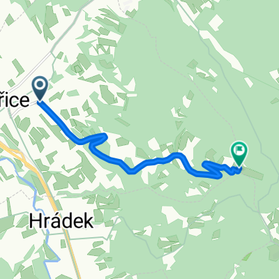
A cycling route starting in Třinec, Moravskoslezský kraj, Czechia.
Overview
About this route
Beskid Śląsko-Morawski
Ostry - Jaworowy
- -:--
- Duration
- 41.2 km
- Distance
- 1,358 m
- Ascent
- 1,358 m
- Descent
- ---
- Avg. speed
- ---
- Avg. speed

Route quality
Waytypes & surfaces along the route
Waytypes
Track
24.2 km
(59 %)
Quiet road
8.2 km
(20 %)
Surfaces
Paved
23.1 km
(56 %)
Unpaved
13.4 km
(33 %)
Asphalt
15.5 km
(38 %)
Gravel
11 km
(27 %)
Continue with Bikemap
Use, edit, or download this cycling route
You would like to ride Beskid Slasko-Morawski Ostry-Jaworowy or customize it for your own trip? Here is what you can do with this Bikemap route:
Free features
- Save this route as favorite or in collections
- Copy & plan your own version of this route
- Sync your route with Garmin or Wahoo
Premium features
Free trial for 3 days, or one-time payment. More about Bikemap Premium.
- Navigate this route on iOS & Android
- Export a GPX / KML file of this route
- Create your custom printout (try it for free)
- Download this route for offline navigation
Discover more Premium features.
Get Bikemap PremiumFrom our community
Other popular routes starting in Třinec
 žermanický okruh
- Distance
- 58.3 km
- Ascent
- 437 m
- Descent
- 431 m
- Location
- Třinec, Moravskoslezský kraj, Czechia
 komorní lhotka - karviná
- Distance
- 33.5 km
- Ascent
- 109 m
- Descent
- 328 m
- Location
- Třinec, Moravskoslezský kraj, Czechia
 MTB Třinec - Ostrý - Bílý kříž - Lysá hora - Třinec
- Distance
- 71.3 km
- Ascent
- 1,885 m
- Descent
- 1,832 m
- Location
- Třinec, Moravskoslezský kraj, Czechia
 Podjazd na Loucke
- Distance
- 5.7 km
- Ascent
- 518 m
- Descent
- 54 m
- Location
- Třinec, Moravskoslezský kraj, Czechia
 MTB - Třinec- M.ostrý - Čantoryje - Sošov - Stožek - Kiczora - Bukovec - Třinec
- Distance
- 63.6 km
- Ascent
- 2,080 m
- Descent
- 2,009 m
- Location
- Třinec, Moravskoslezský kraj, Czechia
 Třinec-Tyra round trip 02
- Distance
- 30 km
- Ascent
- 677 m
- Descent
- 740 m
- Location
- Třinec, Moravskoslezský kraj, Czechia
 Trzycież-Mikoszewo 2011
- Distance
- 740.3 km
- Ascent
- 283 m
- Descent
- 626 m
- Location
- Třinec, Moravskoslezský kraj, Czechia
 ligotka a okolí
- Distance
- 27.4 km
- Ascent
- 257 m
- Descent
- 257 m
- Location
- Třinec, Moravskoslezský kraj, Czechia
Open it in the app