

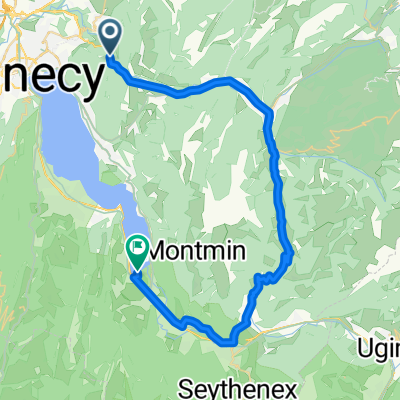
Col de Barman and Chalet Chappuis
A cycling route starting in Dingy-Saint-Clair, Auvergne-Rhône-Alpes, France.
Overview
About this route
- -:--
- Duration
- 20.6 km
- Distance
- 735 m
- Ascent
- 735 m
- Descent
- ---
- Avg. speed
- ---
- Avg. speed

Route quality
Waytypes & surfaces along the route
Waytypes
Quiet road
8.6 km
(42 %)
Road
5.7 km
(28 %)
Surfaces
Unpaved
3 km
(14 %)
Unpaved (undefined)
2.2 km
(11 %)
Ground
0.8 km
(4 %)
Route highlights
Points of interest along the route
Point of interest after 13.7 km
Chalet Chappuis - 1251 metres
Point of interest after 14.5 km
Col de Barman - 1127 metres
Continue with Bikemap
Use, edit, or download this cycling route
You would like to ride Col de Barman and Chalet Chappuis or customize it for your own trip? Here is what you can do with this Bikemap route:
Free features
- Save this route as favorite or in collections
- Copy & plan your own version of this route
- Sync your route with Garmin or Wahoo
Premium features
Free trial for 3 days, or one-time payment. More about Bikemap Premium.
- Navigate this route on iOS & Android
- Export a GPX / KML file of this route
- Create your custom printout (try it for free)
- Download this route for offline navigation
Discover more Premium features.
Get Bikemap PremiumFrom our community
Other popular routes starting in Dingy-Saint-Clair
 Dingy-Faverges Gross
- Distance
- 101.8 km
- Ascent
- 2,424 m
- Descent
- 2,096 m
- Location
- Dingy-Saint-Clair, Auvergne-Rhône-Alpes, France
 LD DOUSSARD
- Distance
- 39.1 km
- Ascent
- 391 m
- Descent
- 518 m
- Location
- Dingy-Saint-Clair, Auvergne-Rhône-Alpes, France
 De Route de Provenat 138, Dingy-Saint-Clair à Promenade Philibert d'Orlye 939, Menthon-Saint-Bernard
- Distance
- 8.4 km
- Ascent
- 105 m
- Descent
- 227 m
- Location
- Dingy-Saint-Clair, Auvergne-Rhône-Alpes, France
 Col de Fry Variante
- Distance
- 82.2 km
- Ascent
- 1,833 m
- Descent
- 1,931 m
- Location
- Dingy-Saint-Clair, Auvergne-Rhône-Alpes, France
 blonniere
- Distance
- 13 km
- Ascent
- 795 m
- Descent
- 795 m
- Location
- Dingy-Saint-Clair, Auvergne-Rhône-Alpes, France
 Alex - Semnoz
- Distance
- 31.2 km
- Ascent
- 1,307 m
- Descent
- 211 m
- Location
- Dingy-Saint-Clair, Auvergne-Rhône-Alpes, France
 Etappe1
- Distance
- 125.4 km
- Ascent
- 2,345 m
- Descent
- 2,416 m
- Location
- Dingy-Saint-Clair, Auvergne-Rhône-Alpes, France
 Crêt de Chatillon
- Distance
- 77.7 km
- Ascent
- 2,437 m
- Descent
- 2,437 m
- Location
- Dingy-Saint-Clair, Auvergne-Rhône-Alpes, France
Open it in the app