

Grenoble-Die-Montbrun-Avignon
A cycling route starting in Saint-Martin-le-Vinoux, Auvergne-Rhône-Alpes, France.
Overview
About this route
Day 1: Grenoble-Die 102 km + 2060 - 1860, col de l'Herboully 1370m, col de Rousset 1254m,
Day 2: Die-Montbrun-les-Bains 103km +1800 -1600, col de Prémol 964m, col de Soubeyrand 987m, Col de Peyruergue 820m, col d'Aulan 845m,
Day 3: 86km, +400m, -1000m, gorges de la Nesque, Belvédère de la Nesque 738m,
- -:--
- Duration
- 291.4 km
- Distance
- 3,194 m
- Ascent
- 3,380 m
- Descent
- ---
- Avg. speed
- ---
- Avg. speed

Route quality
Waytypes & surfaces along the route
Waytypes
Busy road
171.7 km
(59 %)
Road
85.9 km
(29 %)
Surfaces
Paved
151.1 km
(52 %)
Unpaved
0.5 km
(<1 %)
Asphalt
149.8 km
(51 %)
Concrete
0.7 km
(<1 %)
Continue with Bikemap
Use, edit, or download this cycling route
You would like to ride Grenoble-Die-Montbrun-Avignon or customize it for your own trip? Here is what you can do with this Bikemap route:
Free features
- Save this route as favorite or in collections
- Copy & plan your own version of this route
- Sync your route with Garmin or Wahoo
Premium features
Free trial for 3 days, or one-time payment. More about Bikemap Premium.
- Navigate this route on iOS & Android
- Export a GPX / KML file of this route
- Create your custom printout (try it for free)
- Download this route for offline navigation
Discover more Premium features.
Get Bikemap PremiumFrom our community
Other popular routes starting in Saint-Martin-le-Vinoux
 ancien tram-vouillants
- Distance
- 18.4 km
- Ascent
- 587 m
- Descent
- 585 m
- Location
- Saint-Martin-le-Vinoux, Auvergne-Rhône-Alpes, France
 Grenoble-Bernin-Brigaud-Grenoble
- Distance
- 39.5 km
- Ascent
- 250 m
- Descent
- 250 m
- Location
- Saint-Martin-le-Vinoux, Auvergne-Rhône-Alpes, France
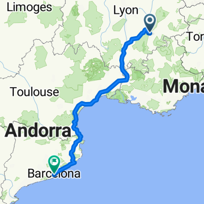
 Grenoble to Barcelona
- Distance
- 751.8 km
- Ascent
- 570 m
- Descent
- 770 m
- Location
- Saint-Martin-le-Vinoux, Auvergne-Rhône-Alpes, France
 Sortie boulot version courte
- Distance
- 19.8 km
- Ascent
- 499 m
- Descent
- 498 m
- Location
- Saint-Martin-le-Vinoux, Auvergne-Rhône-Alpes, France
 Tour de France - Etappe 20
- Distance
- 42.8 km
- Ascent
- 424 m
- Descent
- 417 m
- Location
- Saint-Martin-le-Vinoux, Auvergne-Rhône-Alpes, France
 Test 1 Bastille
- Distance
- 14.1 km
- Ascent
- 542 m
- Descent
- 542 m
- Location
- Saint-Martin-le-Vinoux, Auvergne-Rhône-Alpes, France
 2016 Ride Day 151 - Grenoble to Pont-en-Royans
- Distance
- 69.7 km
- Ascent
- 1,037 m
- Descent
- 1,056 m
- Location
- Saint-Martin-le-Vinoux, Auvergne-Rhône-Alpes, France
 Grenoble to Barcelona
- Distance
- 751.8 km
- Ascent
- 668 m
- Descent
- 870 m
- Location
- Saint-Martin-le-Vinoux, Auvergne-Rhône-Alpes, France
Open it in the app