

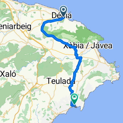
Ruta Pico del Águila
A cycling route starting in Denia, Valencia, Spain.
Overview
About this route
Ruta circular comenzando desde el Pare Pere y subiendo hasta el Pico del Águila.
- -:--
- Duration
- 9.2 km
- Distance
- 598 m
- Ascent
- 601 m
- Descent
- ---
- Avg. speed
- ---
- Avg. speed

Route highlights
Points of interest along the route
Point of interest after 1.3 km
Cruce Camino de la Colonia con la Cova de l'Aigua.
Point of interest after 2.7 km
Pico del águila Parada para almorzar
Point of interest after 3.9 km
Cruce con senda. Ernesto explica algunas de las plantas que se pueden encontrar en el Montgó.
Point of interest after 7.3 km
Camino de la Colonia. Ernesto da explicaciones sobre la colocación de la mochila y el kit de primeros auxilios.
Continue with Bikemap
Use, edit, or download this cycling route
You would like to ride Ruta Pico del Águila or customize it for your own trip? Here is what you can do with this Bikemap route:
Free features
- Save this route as favorite or in collections
- Copy & plan your own version of this route
- Sync your route with Garmin or Wahoo
Premium features
Free trial for 3 days, or one-time payment. More about Bikemap Premium.
- Navigate this route on iOS & Android
- Export a GPX / KML file of this route
- Create your custom printout (try it for free)
- Download this route for offline navigation
Discover more Premium features.
Get Bikemap PremiumFrom our community
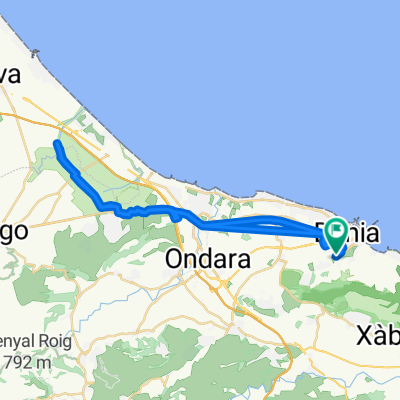
Other popular routes starting in Denia
 Denia Day 1 Pego
- Distance
- 74.5 km
- Ascent
- 376 m
- Descent
- 375 m
- Location
- Denia, Valencia, Spain
 Senderisme Montgó
- Distance
- 14.8 km
- Ascent
- 792 m
- Descent
- 792 m
- Location
- Denia, Valencia, Spain
 Ruta TCAF- Josemi
- Distance
- 25.9 km
- Ascent
- 400 m
- Descent
- 400 m
- Location
- Denia, Valencia, Spain
 Dénia - Moraira
- Distance
- 27.6 km
- Ascent
- 354 m
- Descent
- 355 m
- Location
- Denia, Valencia, Spain
 SAC Vuelta Via Verdes Rondrit vanuit Denia
- Distance
- 39.5 km
- Ascent
- 423 m
- Descent
- 423 m
- Location
- Denia, Valencia, Spain
 156 km - Denia-Rates-Guadalest-Gorga-Toios-Ebo-Tormos-Orba-Denia
- Distance
- 156.4 km
- Ascent
- 1,948 m
- Descent
- 1,940 m
- Location
- Denia, Valencia, Spain
 Ruta hacia la Font Salada.
- Distance
- 42.6 km
- Ascent
- 64 m
- Descent
- 64 m
- Location
- Denia, Valencia, Spain
 ruta de montaña
- Distance
- 9.9 km
- Ascent
- 778 m
- Descent
- 716 m
- Location
- Denia, Valencia, Spain
Open it in the app