

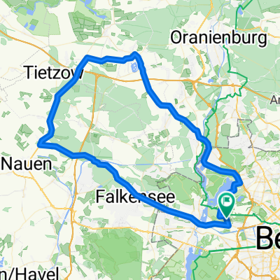
Rundkurs: Spandau-Börnicke-Nauen und zurück
A cycling route starting in Siemensstadt, Land Berlin, Germany.
Overview
About this route
Dieser Track ist von mir tatsächlich abgefahren.
Ich habe die GPX-Datei mit einigen Wegpunkten versehen, die hilfreich sein können, wenn man sich auf dieser Strecke nicht oder nicht so gut auskennt.
Da die jedoch beim Upload verloren gehen, bin ich auch gerne bereit die GPS-Datei zur Verfügung zu stellen:
Am besten über
MSN: Kuma77@live.com oder
Mail: xdhpko@web.de
Betreff: Bör-Nau2.gpx
Viel Spaß beim nachradeln...
- -:--
- Duration
- 82.1 km
- Distance
- 129 m
- Ascent
- 128 m
- Descent
- ---
- Avg. speed
- ---
- Avg. speed

Route quality
Waytypes & surfaces along the route
Waytypes
Cycleway
23.2 km
(28 %)
Path
18.4 km
(22 %)
Surfaces
Paved
69.4 km
(85 %)
Unpaved
0.6 km
(<1 %)
Asphalt
48.4 km
(59 %)
Paving stones
19.2 km
(23 %)
Continue with Bikemap
Use, edit, or download this cycling route
You would like to ride Rundkurs: Spandau-Börnicke-Nauen und zurück or customize it for your own trip? Here is what you can do with this Bikemap route:
Free features
- Save this route as favorite or in collections
- Copy & plan your own version of this route
- Sync your route with Garmin or Wahoo
Premium features
Free trial for 3 days, or one-time payment. More about Bikemap Premium.
- Navigate this route on iOS & Android
- Export a GPX / KML file of this route
- Create your custom printout (try it for free)
- Download this route for offline navigation
Discover more Premium features.
Get Bikemap PremiumFrom our community
Other popular routes starting in Siemensstadt
 Auerbach->R1->Golzow 09.08.2008
- Distance
- 177.8 km
- Ascent
- 492 m
- Descent
- 482 m
- Location
- Siemensstadt, Land Berlin, Germany
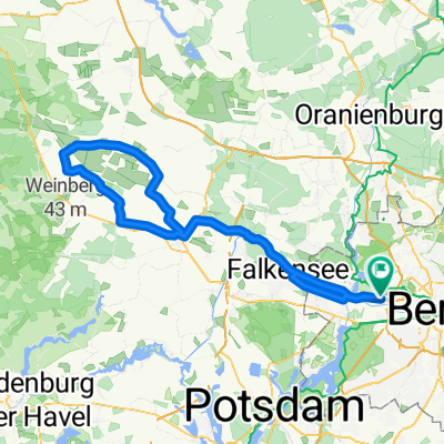
 Spandau-Tegel-Groß Ziethen-Börnicke-Falkensee-Spandau
- Distance
- 81 km
- Ascent
- 148 m
- Descent
- 144 m
- Location
- Siemensstadt, Land Berlin, Germany
 Kleine Feierabendrunde 11.09.09
- Distance
- 79.7 km
- Ascent
- 449 m
- Descent
- 432 m
- Location
- Siemensstadt, Land Berlin, Germany
 Havel+TeglerSee
- Distance
- 40.5 km
- Ascent
- 62 m
- Descent
- 63 m
- Location
- Siemensstadt, Land Berlin, Germany
 Etapa 043C (Berlín - Rabenstein)
- Distance
- 126.8 km
- Ascent
- 917 m
- Descent
- 844 m
- Location
- Siemensstadt, Land Berlin, Germany
 Sonntagsrunde mit den »Havellandriders« 31.08.08
- Distance
- 112.5 km
- Ascent
- 115 m
- Descent
- 116 m
- Location
- Siemensstadt, Land Berlin, Germany
 Falkensee -> Fehrbellin
- Distance
- 146.6 km
- Ascent
- 200 m
- Descent
- 196 m
- Location
- Siemensstadt, Land Berlin, Germany
 Beetzseerunde am 8.11.2008
- Distance
- 141.6 km
- Ascent
- 384 m
- Descent
- 377 m
- Location
- Siemensstadt, Land Berlin, Germany
Open it in the app