
ste 3
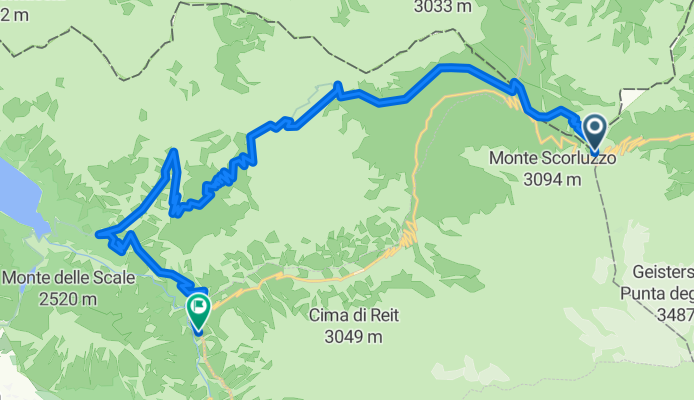
A cycling route starting in Sant'Antonio, Lombardy, Italy.
Overview
About this route
Punta Garibaldi
Forcola di Rims
Pedenolo
Boscopiano
- -:--
- Duration
- 24 km
- Distance
- 402 m
- Ascent
- 1,672 m
- Descent
- ---
- Avg. speed
- ---
- Avg. speed

Route quality
Waytypes & surfaces along the route
Waytypes
Track
13.4 km
(56 %)
Path
10.4 km
(43 %)
Surfaces
Paved
0.1 km
(<1 %)
Unpaved
22.2 km
(93 %)
Ground
13.8 km
(57 %)
Unpaved (undefined)
4 km
(17 %)
Continue with Bikemap
Use, edit, or download this cycling route
You would like to ride ste 3 or customize it for your own trip? Here is what you can do with this Bikemap route:
Free features
- Save this route as favorite or in collections
- Copy & plan your own version of this route
- Sync your route with Garmin or Wahoo
Premium features
Free trial for 3 days, or one-time payment. More about Bikemap Premium.
- Navigate this route on iOS & Android
- Export a GPX / KML file of this route
- Create your custom printout (try it for free)
- Download this route for offline navigation
Discover more Premium features.
Get Bikemap PremiumFrom our community
Other popular routes starting in Sant'Antonio
 Santa Caterina-Passo Gavia-Passo Mortirolo-Santa Caterina
- Distance
- 107.2 km
- Ascent
- 2,942 m
- Descent
- 2,942 m
- Location
- Sant'Antonio, Lombardy, Italy
 Goldseetrail - Vinschgau
- Distance
- 21.4 km
- Ascent
- 275 m
- Descent
- 2,119 m
- Location
- Sant'Antonio, Lombardy, Italy
 Santa Caterina - Bormio - Passo dello Stelvio & zurück
- Distance
- 67.6 km
- Ascent
- 2,120 m
- Descent
- 2,120 m
- Location
- Sant'Antonio, Lombardy, Italy
 Stilfserjoch (Südtirol)
- Distance
- 27.2 km
- Ascent
- 32 m
- Descent
- 1,899 m
- Location
- Sant'Antonio, Lombardy, Italy
 Santa Caterina - Passo del Gavia
- Distance
- 13.3 km
- Ascent
- 970 m
- Descent
- 87 m
- Location
- Sant'Antonio, Lombardy, Italy
 Gavia Pass Runde
- Distance
- 138.6 km
- Ascent
- 3,211 m
- Descent
- 3,211 m
- Location
- Sant'Antonio, Lombardy, Italy
 03.09.2016 Goldseetrail
- Distance
- 31.9 km
- Ascent
- 513 m
- Descent
- 2,307 m
- Location
- Sant'Antonio, Lombardy, Italy
 CF3J+MW, Valfurva do Strada Statale 300, Valfurva
- Distance
- 27 km
- Ascent
- 4,739 m
- Descent
- 5,195 m
- Location
- Sant'Antonio, Lombardy, Italy
Open it in the app