
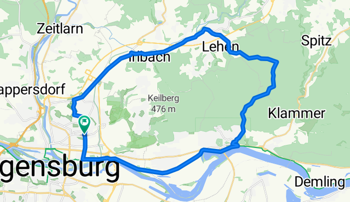
Regensburg-Wenzenbach-Donaustauf-Regensburg
A cycling route starting in Regensburg, Bavaria, Germany.
Overview
About this route
Start und Ziel in Regensburg Isarstraße Ecke Lechstraße Über Wutzlhofen und Irlbach nach Wenzenbach (Straße) Dort ca. 300m nach der Kirche rechts Richtung Friedhof abbiegen. Nach Steinbügl rechts in den Waldweg. Nach einigen Kilometern wieder rechts , runter nach Donaustauf (alles Waldweg) Von Donaustauf auf dem Donauradweg zurück nach Regensburg. Wegen der steinigen Waldwege für Rennradfahrer nur bedingt geeignet!
- -:--
- Duration
- 27 km
- Distance
- 287 m
- Ascent
- 295 m
- Descent
- ---
- Avg. speed
- 527 m
- Avg. speed
Route quality
Waytypes & surfaces along the route
Waytypes
Road
10.5 km
(39 %)
Quiet road
4.8 km
(18 %)
Surfaces
Paved
21.5 km
(80 %)
Unpaved
3.7 km
(14 %)
Asphalt
21 km
(78 %)
Gravel
3.6 km
(13 %)
Continue with Bikemap
Use, edit, or download this cycling route
You would like to ride Regensburg-Wenzenbach-Donaustauf-Regensburg or customize it for your own trip? Here is what you can do with this Bikemap route:
Free features
- Save this route as favorite or in collections
- Copy & plan your own version of this route
- Sync your route with Garmin or Wahoo
Premium features
Free trial for 3 days, or one-time payment. More about Bikemap Premium.
- Navigate this route on iOS & Android
- Export a GPX / KML file of this route
- Create your custom printout (try it for free)
- Download this route for offline navigation
Discover more Premium features.
Get Bikemap PremiumFrom our community
Other popular routes starting in Regensburg
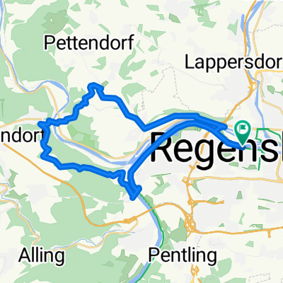
 Fünf-Flüsse-Radtour mit Start in Regensburg
- Distance
- 308.4 km
- Ascent
- 2,967 m
- Descent
- 3,006 m
- Location
- Regensburg, Bavaria, Germany
 Regensburg Altenthann + zurück
- Distance
- 43.2 km
- Ascent
- 530 m
- Descent
- 538 m
- Location
- Regensburg, Bavaria, Germany
 Ausgedehnte Feierabendtour
- Distance
- 62.9 km
- Ascent
- 392 m
- Descent
- 392 m
- Location
- Regensburg, Bavaria, Germany
 Mittlere Tour Regensburg - Donau und zurück
- Distance
- 20.7 km
- Ascent
- 222 m
- Descent
- 182 m
- Location
- Regensburg, Bavaria, Germany
 Der Norden Regensburgs
- Distance
- 105.3 km
- Ascent
- 535 m
- Descent
- 536 m
- Location
- Regensburg, Bavaria, Germany
 Rgbg-Marienhöhe-Etterzhausen-Adlersberg-Rgbg
- Distance
- 25.2 km
- Ascent
- 274 m
- Descent
- 274 m
- Location
- Regensburg, Bavaria, Germany
 Trailhunter
- Distance
- 55.7 km
- Ascent
- 746 m
- Descent
- 729 m
- Location
- Regensburg, Bavaria, Germany
 Donau - Laber Tour über Lindach
- Distance
- 44.6 km
- Ascent
- 435 m
- Descent
- 433 m
- Location
- Regensburg, Bavaria, Germany
Open it in the app