

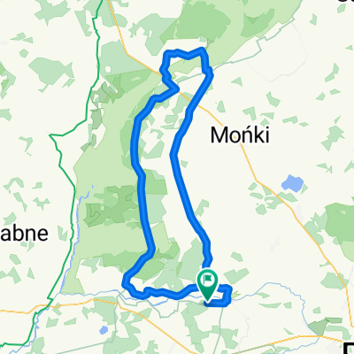
Tykocin - Wizna - Łomża - Czerwone - Nowgród
A cycling route starting in Tykocin, Podlasie Voivodship, Poland.
Overview
About this route
03 czerwic 2018
- -:--
- Duration
- 126.1 km
- Distance
- 292 m
- Ascent
- 274 m
- Descent
- ---
- Avg. speed
- ---
- Avg. speed

Route quality
Waytypes & surfaces along the route
Waytypes
Busy road
64.5 km
(51 %)
Road
17.8 km
(14 %)
Surfaces
Paved
99.1 km
(79 %)
Unpaved
1.8 km
(1 %)
Asphalt
86.9 km
(69 %)
Paving stones
12 km
(9 %)
Continue with Bikemap
Use, edit, or download this cycling route
You would like to ride Tykocin - Wizna - Łomża - Czerwone - Nowgród or customize it for your own trip? Here is what you can do with this Bikemap route:
Free features
- Save this route as favorite or in collections
- Copy & plan your own version of this route
- Sync your route with Garmin or Wahoo
Premium features
Free trial for 3 days, or one-time payment. More about Bikemap Premium.
- Navigate this route on iOS & Android
- Export a GPX / KML file of this route
- Create your custom printout (try it for free)
- Download this route for offline navigation
Discover more Premium features.
Get Bikemap PremiumFrom our community
Other popular routes starting in Tykocin
 U-4-9._Kruszewo-Rogowo Kolonia-Białystok
- Distance
- 24.6 km
- Ascent
- 111 m
- Descent
- 85 m
- Location
- Tykocin, Podlasie Voivodship, Poland
 lato 2011/2
- Distance
- 66.7 km
- Ascent
- 56 m
- Descent
- 52 m
- Location
- Tykocin, Podlasie Voivodship, Poland
 Tykocin - Augustów
- Distance
- 112.2 km
- Ascent
- 178 m
- Descent
- 161 m
- Location
- Tykocin, Podlasie Voivodship, Poland
 wokół Podlasia_II dzień(26.04.2011)_BiebrzPN
- Distance
- 105.9 km
- Ascent
- 139 m
- Descent
- 141 m
- Location
- Tykocin, Podlasie Voivodship, Poland
 bagna Narew
- Distance
- 23.9 km
- Ascent
- 246 m
- Descent
- 254 m
- Location
- Tykocin, Podlasie Voivodship, Poland
 WYPRAWA 2021 Z AUGUSTOWA DZIEŃ 3
- Distance
- 52.7 km
- Ascent
- 231 m
- Descent
- 209 m
- Location
- Tykocin, Podlasie Voivodship, Poland
 narwiański park
- Distance
- 31.6 km
- Ascent
- 82 m
- Descent
- 85 m
- Location
- Tykocin, Podlasie Voivodship, Poland
 Biebrzański
- Distance
- 92.2 km
- Ascent
- 98 m
- Descent
- 98 m
- Location
- Tykocin, Podlasie Voivodship, Poland
Open it in the app