

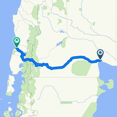
SAN ANTONIO ESTE a PUNTA PERDICES
A cycling route starting in San Antonio Oeste, Río Negro Province, Argentina.
Overview
About this route
Recorrido Mountain desde el puerto de San antonio Este a el balneario de Punta perdices, un verdadero paraiso en la costa Argentina
- -:--
- Duration
- 4.6 km
- Distance
- 4 m
- Ascent
- 15 m
- Descent
- ---
- Avg. speed
- ---
- Avg. speed

Route quality
Waytypes & surfaces along the route
Waytypes
Quiet road
4.3 km
(94 %)
Busy road
0.3 km
(6 %)
Undefined
-0 km
(<1 %)
Surfaces
Paved
0.3 km
(6 %)
Unpaved
4.3 km
(94 %)
Unpaved (undefined)
3.3 km
(71 %)
Pebblestone
1.1 km
(23 %)
Route highlights
Points of interest along the route

Point of interest after 1.3 km
Mirador Norte, frente al puerto.
Continue with Bikemap
Use, edit, or download this cycling route
You would like to ride SAN ANTONIO ESTE a PUNTA PERDICES or customize it for your own trip? Here is what you can do with this Bikemap route:
Free features
- Save this route as favorite or in collections
- Copy & plan your own version of this route
- Sync your route with Garmin or Wahoo
Premium features
Free trial for 3 days, or one-time payment. More about Bikemap Premium.
- Navigate this route on iOS & Android
- Export a GPX / KML file of this route
- Create your custom printout (try it for free)
- Download this route for offline navigation
Discover more Premium features.
Get Bikemap PremiumFrom our community
Other popular routes starting in San Antonio Oeste
 Las grutas - El Fuerte
- Distance
- 37.1 km
- Ascent
- 146 m
- Descent
- 47 m
- Location
- San Antonio Oeste, Río Negro Province, Argentina
 De Antartida Argentina 1858, San Antonio Oeste a Martin Fierro 241, San Antonio Oeste
- Distance
- 35 km
- Ascent
- 129 m
- Descent
- 140 m
- Location
- San Antonio Oeste, Río Negro Province, Argentina
 Las grutas
- Distance
- 37.4 km
- Ascent
- 233 m
- Descent
- 233 m
- Location
- San Antonio Oeste, Río Negro Province, Argentina
 San Antonio Oeste - Viedma (Camino de la Costa)
- Distance
- 259.8 km
- Ascent
- 611 m
- Descent
- 617 m
- Location
- San Antonio Oeste, Río Negro Province, Argentina
 FUERTE ARGENTINO--LAS GRUTAS,,
- Distance
- 35.8 km
- Ascent
- 36 m
- Descent
- 39 m
- Location
- San Antonio Oeste, Río Negro Province, Argentina
 RUTA DE LOS ACANTILADOS--RIO NEGRO
- Distance
- 201.6 km
- Ascent
- 283 m
- Descent
- 294 m
- Location
- San Antonio Oeste, Río Negro Province, Argentina
 San Antonio Oeste to Valdivia with stops
- Distance
- 1,031.4 km
- Ascent
- 2,115 m
- Descent
- 2,114 m
- Location
- San Antonio Oeste, Río Negro Province, Argentina
 Vuelta a la Argentina. Parte 10
- Distance
- 189.9 km
- Ascent
- 196 m
- Descent
- 218 m
- Location
- San Antonio Oeste, Río Negro Province, Argentina
Open it in the app