

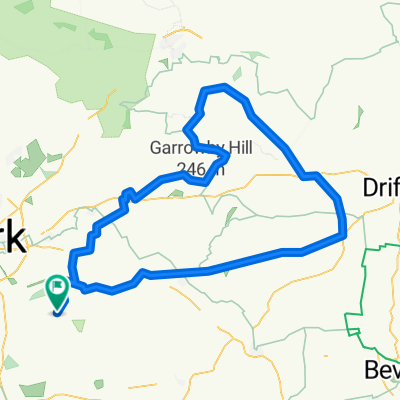
Road (One way) - Wheldrake to Holyrood
A cycling route starting in Wheldrake, England, United Kingdom.
Overview
About this route
- -:--
- Duration
- 78.8 km
- Distance
- 227 m
- Ascent
- 227 m
- Descent
- ---
- Avg. speed
- ---
- Avg. speed
Route quality
Waytypes & surfaces along the route
Waytypes
Quiet road
33 km
(42 %)
Busy road
28.9 km
(37 %)
Surfaces
Paved
21.5 km
(27 %)
Asphalt
21.5 km
(27 %)
Undefined
57.3 km
(73 %)
Continue with Bikemap
Use, edit, or download this cycling route
You would like to ride Road (One way) - Wheldrake to Holyrood or customize it for your own trip? Here is what you can do with this Bikemap route:
Free features
- Save this route as favorite or in collections
- Copy & plan your own version of this route
- Sync your route with Garmin or Wahoo
Premium features
Free trial for 3 days, or one-time payment. More about Bikemap Premium.
- Navigate this route on iOS & Android
- Export a GPX / KML file of this route
- Create your custom printout (try it for free)
- Download this route for offline navigation
Discover more Premium features.
Get Bikemap PremiumFrom our community
Other popular routes starting in Wheldrake
 Road (Circular) - Wheldrake to Riccall
- Distance
- 40.8 km
- Ascent
- 47 m
- Descent
- 46 m
- Location
- Wheldrake, England, United Kingdom
 9 Blake Ct, York to 9 Blake Ct, York
- Distance
- 42 km
- Ascent
- 9 m
- Descent
- 18 m
- Location
- Wheldrake, England, United Kingdom
 Wheldrake Lane to Grainger Drive 5
- Distance
- 22.7 km
- Ascent
- 48 m
- Descent
- 67 m
- Location
- Wheldrake, England, United Kingdom
 Road (Circular) - Wheldrake to North Grimston
- Distance
- 99.3 km
- Ascent
- 604 m
- Descent
- 606 m
- Location
- Wheldrake, England, United Kingdom
 9 Blake Ct, York to 9 Blake Ct, York
- Distance
- 47.9 km
- Ascent
- 0 m
- Descent
- 8 m
- Location
- Wheldrake, England, United Kingdom
 9 Blake Ct, York to Elm Tree Farm, York Road, York
- Distance
- 38.2 km
- Ascent
- 6 m
- Descent
- 15 m
- Location
- Wheldrake, England, United Kingdom
 Route 2
- Distance
- 56.8 km
- Ascent
- 28 m
- Descent
- 28 m
- Location
- Wheldrake, England, United Kingdom
 Wheldrake, Skipwith, Barlby, Selby, Cawood, Naburn, Wheldrake loop.
- Distance
- 49.4 km
- Ascent
- 39 m
- Descent
- 41 m
- Location
- Wheldrake, England, United Kingdom
Open it in the app