

Kalvarienbergrunde CLONED FROM ROUTE 197767
A cycling route starting in Speinshart, Bavaria, Germany.
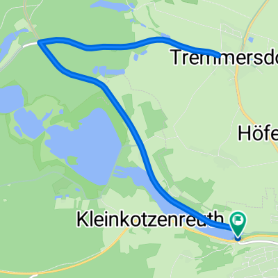
Overview
About this route
sehr ruhige und schöne Streckenführung, Anstiege in erträglichem Umfang, Einkehrmöglichkeit in Schlammersdorf, teilweise noch verbesserungsbedürftiger Streckenverlauf auf dem Abschnitt von Heinersreuth nach Schlammersdorf und weiter nach Moos, da auf Hauptstraße ohne Radweg
- -:--
- Duration
- 40.8 km
- Distance
- 445 m
- Ascent
- 445 m
- Descent
- ---
- Avg. speed
- ---
- Avg. speed
Continue with Bikemap
Use, edit, or download this cycling route
You would like to ride Kalvarienbergrunde CLONED FROM ROUTE 197767 or customize it for your own trip? Here is what you can do with this Bikemap route:
Free features
- Save this route as favorite or in collections
- Copy & plan your own version of this route
- Sync your route with Garmin or Wahoo
Premium features
Free trial for 3 days, or one-time payment. More about Bikemap Premium.
- Navigate this route on iOS & Android
- Export a GPX / KML file of this route
- Create your custom printout (try it for free)
- Download this route for offline navigation
Discover more Premium features.
Get Bikemap PremiumFrom our community
Other popular routes starting in Speinshart
 LL-02-1 Eschenbach - Tirschenreuth
- Distance
- 33.6 km
- Ascent
- 580 m
- Descent
- 515 m
- Location
- Speinshart, Bavaria, Germany
 Tria Eschenbach Rad-Strecke
- Distance
- 12.7 km
- Ascent
- 123 m
- Descent
- 123 m
- Location
- Speinshart, Bavaria, Germany
 Neustadt a.K.-Erbendorf-und zurück
- Distance
- 55.9 km
- Ascent
- 386 m
- Descent
- 386 m
- Location
- Speinshart, Bavaria, Germany
 Kalvarienbergrunde CLONED FROM ROUTE 197767
- Distance
- 40.8 km
- Ascent
- 445 m
- Descent
- 445 m
- Location
- Speinshart, Bavaria, Germany
 Beck‘n Runde
- Distance
- 69 km
- Ascent
- 1,047 m
- Descent
- 1,048 m
- Location
- Speinshart, Bavaria, Germany
 Fichtelgebirgstour
- Distance
- 85.3 km
- Ascent
- 891 m
- Descent
- 894 m
- Location
- Speinshart, Bavaria, Germany
 Kalvarienbergrunde
- Distance
- 40.8 km
- Ascent
- 445 m
- Descent
- 445 m
- Location
- Speinshart, Bavaria, Germany
 Rußweiher Route
- Distance
- 20.8 km
- Ascent
- 170 m
- Descent
- 170 m
- Location
- Speinshart, Bavaria, Germany
Open it in the app