

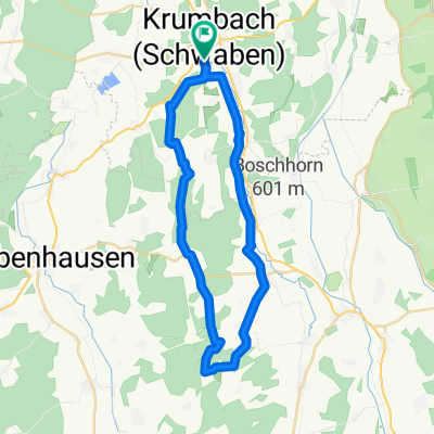
Krumbach (Schwaben) - Günzquelle
A cycling route starting in Krumbach, Bavaria, Germany.
Overview
About this route
Von Krumbach (Schwaben) zum Ursprung der Östlichen Günz auf dem offiziellen Günztalradweg.
- -:--
- Duration
- 66.8 km
- Distance
- 381 m
- Ascent
- 78 m
- Descent
- ---
- Avg. speed
- ---
- Avg. speed

Route quality
Waytypes & surfaces along the route
Waytypes
Quiet road
31 km
(46 %)
Track
16.4 km
(25 %)
Surfaces
Paved
31 km
(46 %)
Unpaved
7.7 km
(11 %)
Asphalt
23.6 km
(35 %)
Gravel
7.7 km
(11 %)
Continue with Bikemap
Use, edit, or download this cycling route
You would like to ride Krumbach (Schwaben) - Günzquelle or customize it for your own trip? Here is what you can do with this Bikemap route:
Free features
- Save this route as favorite or in collections
- Copy & plan your own version of this route
- Sync your route with Garmin or Wahoo
Premium features
Free trial for 3 days, or one-time payment. More about Bikemap Premium.
- Navigate this route on iOS & Android
- Export a GPX / KML file of this route
- Create your custom printout (try it for free)
- Download this route for offline navigation
Discover more Premium features.
Get Bikemap PremiumFrom our community
Other popular routes starting in Krumbach
 Krumbach-Röfingen
- Distance
- 66.5 km
- Ascent
- 463 m
- Descent
- 464 m
- Location
- Krumbach, Bavaria, Germany
 Von Krumbach übers Katzenhirn zum Füchsle
- Distance
- 98.1 km
- Ascent
- 6,054 m
- Descent
- 6,561 m
- Location
- Krumbach, Bavaria, Germany
 Krumbach-Autenried
- Distance
- 63 km
- Ascent
- 547 m
- Descent
- 543 m
- Location
- Krumbach, Bavaria, Germany
 Radlwallfahren CLONED FROM ROUTE 1763273
- Distance
- 38.1 km
- Ascent
- 272 m
- Descent
- 272 m
- Location
- Krumbach, Bavaria, Germany
 Tag2_Bayrisch-Schwaben
- Distance
- 79.1 km
- Ascent
- 298 m
- Descent
- 299 m
- Location
- Krumbach, Bavaria, Germany
 Krumbach - Kammeltal - Edelstetten - Krumbach
- Distance
- 38 km
- Ascent
- 159 m
- Descent
- 157 m
- Location
- Krumbach, Bavaria, Germany
 Krumbach - Edenhausen - Mindelzell - Winzer - Niederraunau - Krumbach
- Distance
- 24.6 km
- Ascent
- 247 m
- Descent
- 249 m
- Location
- Krumbach, Bavaria, Germany
 Krumbach (Schwaben) - Holzgerlinden (Böblingen)
- Distance
- 144.1 km
- Ascent
- 1,120 m
- Descent
- 1,159 m
- Location
- Krumbach, Bavaria, Germany
Open it in the app