

Stubenberg-Pöllauberg, Sonntag, 18. August 2019
A cycling route starting in Stubenberg, Styria, Austria.
Overview
About this route
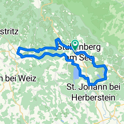
Strecke: Stubenberg (Schloss Schielleiten) - Untertiefenbach - Hofkirchen - Winzendorf - Pöllau - Pöllauberg Länge: 23.000m // HM 460 Mehr Infos: www.radsportwoche.hartberg.at
- -:--
- Duration
- 23 km
- Distance
- 496 m
- Ascent
- 170 m
- Descent
- ---
- Avg. speed
- ---
- Avg. speed

Route quality
Waytypes & surfaces along the route
Waytypes
Busy road
11.8 km
(51 %)
Road
5.6 km
(24 %)
Surfaces
Paved
11.7 km
(51 %)
Asphalt
11.5 km
(50 %)
Paved (undefined)
0.1 km
(<1 %)
Undefined
11.4 km
(49 %)
Continue with Bikemap
Use, edit, or download this cycling route
You would like to ride Stubenberg-Pöllauberg, Sonntag, 18. August 2019 or customize it for your own trip? Here is what you can do with this Bikemap route:
Free features
- Save this route as favorite or in collections
- Copy & plan your own version of this route
- Sync your route with Garmin or Wahoo
Premium features
Free trial for 3 days, or one-time payment. More about Bikemap Premium.
- Navigate this route on iOS & Android
- Export a GPX / KML file of this route
- Create your custom printout (try it for free)
- Download this route for offline navigation
Discover more Premium features.
Get Bikemap PremiumFrom our community
Other popular routes starting in Stubenberg
 Stubenbergsee - Ackerwirt - Stubenbergsee
- Distance
- 18.4 km
- Ascent
- 459 m
- Descent
- 459 m
- Location
- Stubenberg, Styria, Austria
 Feistritztal
- Distance
- 19.1 km
- Ascent
- 257 m
- Descent
- 104 m
- Location
- Stubenberg, Styria, Austria
 kulm runde
- Distance
- 40.1 km
- Ascent
- 961 m
- Descent
- 1,105 m
- Location
- Stubenberg, Styria, Austria
 Apfeland Stubenberg triathlon
- Distance
- 43.6 km
- Ascent
- 442 m
- Descent
- 402 m
- Location
- Stubenberg, Styria, Austria
 stubenberg a. see - wien (margareten)
- Distance
- 171.4 km
- Ascent
- 2,493 m
- Descent
- 2,834 m
- Location
- Stubenberg, Styria, Austria
 Kleine Stubenbergrunde
- Distance
- 29.5 km
- Ascent
- 375 m
- Descent
- 374 m
- Location
- Stubenberg, Styria, Austria
 Apfellandtour
- Distance
- 64.4 km
- Ascent
- 1,189 m
- Descent
- 1,189 m
- Location
- Stubenberg, Styria, Austria
 Stubenberg-Runde zur Burg
- Distance
- 22.1 km
- Ascent
- 394 m
- Descent
- 399 m
- Location
- Stubenberg, Styria, Austria
Open it in the app