
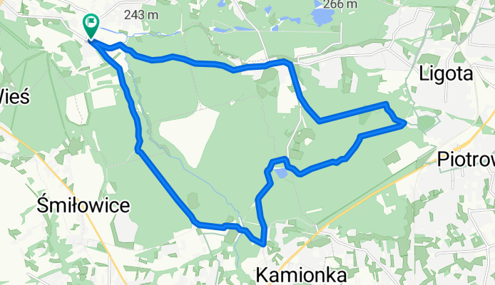
Ruda Śląska Piłsudskiego - Mikołów Jamna - Starganiec - Katowice Piotrowice Park Zadole - Stare Panewniki - Ruda Śląska Stara Kuźnica - Ruda Śl. Piłsudskiego
A cycling route starting in Ruda Śląska, Silesian Voivodeship, Poland.
Overview
About this route
- -:--
- Duration
- 19.5 km
- Distance
- 84 m
- Ascent
- 85 m
- Descent
- ---
- Avg. speed
- ---
- Avg. speed

Route quality
Waytypes & surfaces along the route
Waytypes
Track
13.7 km
(70 %)
Quiet road
2.6 km
(13 %)
Surfaces
Paved
4.5 km
(23 %)
Unpaved
13.8 km
(71 %)
Ground
10.1 km
(52 %)
Asphalt
3.1 km
(16 %)
Continue with Bikemap
Use, edit, or download this cycling route
You would like to ride Ruda Śląska Piłsudskiego - Mikołów Jamna - Starganiec - Katowice Piotrowice Park Zadole - Stare Panewniki - Ruda Śląska Stara Kuźnica - Ruda Śl. Piłsudskiego or customize it for your own trip? Here is what you can do with this Bikemap route:
Free features
- Save this route as favorite or in collections
- Copy & plan your own version of this route
- Sync your route with Garmin or Wahoo
Premium features
Free trial for 3 days, or one-time payment. More about Bikemap Premium.
- Navigate this route on iOS & Android
- Export a GPX / KML file of this route
- Create your custom printout (try it for free)
- Download this route for offline navigation
Discover more Premium features.
Get Bikemap PremiumFrom our community
Other popular routes starting in Ruda Śląska
 Orlen-Rybaczówka browar-buczyna-Orlen
- Distance
- 18.7 km
- Ascent
- 172 m
- Descent
- 166 m
- Location
- Ruda Śląska, Silesian Voivodeship, Poland
 Ruda Śląska Wirek Wyzwolenia - Chorzów Park Śląski/Katowice Złota
- Distance
- 14.3 km
- Ascent
- 134 m
- Descent
- 114 m
- Location
- Ruda Śląska, Silesian Voivodeship, Poland
 Pętla Jamna 20km
- Distance
- 19.9 km
- Ascent
- 213 m
- Descent
- 238 m
- Location
- Ruda Śląska, Silesian Voivodeship, Poland
 Lengthy bike tour from Ruda Śląska to Orzesze
- Distance
- 36.3 km
- Ascent
- 220 m
- Descent
- 211 m
- Location
- Ruda Śląska, Silesian Voivodeship, Poland
 Kochłowice orlen - tychy paprocany
- Distance
- 55.2 km
- Ascent
- 223 m
- Descent
- 217 m
- Location
- Ruda Śląska, Silesian Voivodeship, Poland
 Rynek-Przystań-Starganiec-StarganiecRybaczówka-Rynek
- Distance
- 23.2 km
- Ascent
- 130 m
- Descent
- 127 m
- Location
- Ruda Śląska, Silesian Voivodeship, Poland
 Lasem
Lasem- Distance
- 31.9 km
- Ascent
- 143 m
- Descent
- 107 m
- Location
- Ruda Śląska, Silesian Voivodeship, Poland
 Do Chudowa
- Distance
- 28.9 km
- Ascent
- 86 m
- Descent
- 85 m
- Location
- Ruda Śląska, Silesian Voivodeship, Poland
Open it in the app