
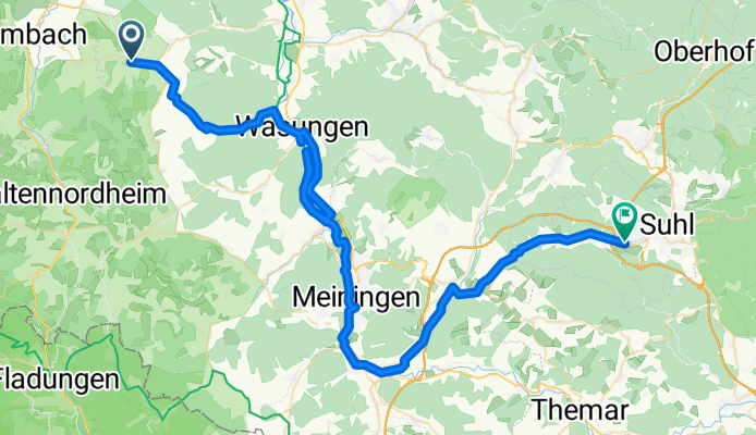
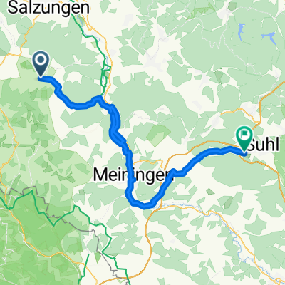
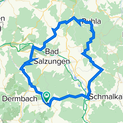
Vorderrhön nach Suhl über Meiningen
A cycling route starting in Roßdorf, Free State of Thuringia, Germany.
Overview
About this route
Die Tour an sich habe ich das erste mal gefahren. Die Radwege sind größtenteils gut ausgebaut. Die Beschilderung lässt aber oft zu wünschen übrig. Kann natürlich auch daran liegen das ich kurz nach Vandalentag, sprich Christi-Himmelfahrt gefahren bin.
Ab und an fährt man Straße, ist aber alles erträglich. Mir persönlich gefallen die ersten Kilometer besser da nach einem Anstieg auch mal ein Rollen lassen kommt. Wohingegen man dem Werra-Radweg bzw Hasel-Radweg folgend am Wasser immer in die Pedale treten muss. Das ist natürlich Geschmacks- und Konditionssache, welche bei mir dieses Jahr ihr Training gerade erst beginnt. Eine Karte bzw Navigation sind von Vorteil, aber kein Muss.
- -:--
- Duration
- 68.4 km
- Distance
- 267 m
- Ascent
- 252 m
- Descent
- ---
- Avg. speed
- ---
- Avg. speed

Route quality
Waytypes & surfaces along the route
Waytypes
Quiet road
17.8 km
(26 %)
Track
16 km
(23 %)
Surfaces
Paved
47 km
(69 %)
Unpaved
11.5 km
(17 %)
Asphalt
46 km
(67 %)
Gravel
11.1 km
(16 %)
Continue with Bikemap
Use, edit, or download this cycling route
You would like to ride Vorderrhön nach Suhl über Meiningen or customize it for your own trip? Here is what you can do with this Bikemap route:
Free features
- Save this route as favorite or in collections
- Copy & plan your own version of this route
- Sync your route with Garmin or Wahoo
Premium features
Free trial for 3 days, or one-time payment. More about Bikemap Premium.
- Navigate this route on iOS & Android
- Export a GPX / KML file of this route
- Create your custom printout (try it for free)
- Download this route for offline navigation
Discover more Premium features.
Get Bikemap PremiumFrom our community
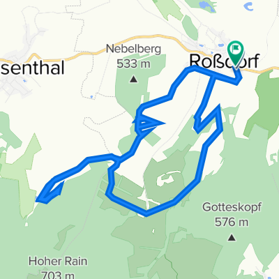
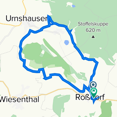
Other popular routes starting in Roßdorf
 Vorderrhön nach Suhl über Meiningen
- Distance
- 68.4 km
- Ascent
- 267 m
- Descent
- 252 m
- Location
- Roßdorf, Free State of Thuringia, Germany
 Hauptstraße 36, Roßdorf nach Hauptstraße 30, Roßdorf
- Distance
- 16.1 km
- Ascent
- 795 m
- Descent
- 791 m
- Location
- Roßdorf, Free State of Thuringia, Germany
 Untertor 7, Roßdorf nach Hauptstraße 25, Roßdorf
- Distance
- 14.7 km
- Ascent
- 490 m
- Descent
- 488 m
- Location
- Roßdorf, Free State of Thuringia, Germany
 Franzosenskizze 2 Hochrhön
- Distance
- 105.4 km
- Ascent
- 1,711 m
- Descent
- 1,707 m
- Location
- Roßdorf, Free State of Thuringia, Germany
 Franzosenskizze 1
- Distance
- 84.5 km
- Ascent
- 1,412 m
- Descent
- 1,413 m
- Location
- Roßdorf, Free State of Thuringia, Germany
 RossDorf 11 Km
- Distance
- 10.8 km
- Ascent
- 297 m
- Descent
- 298 m
- Location
- Roßdorf, Free State of Thuringia, Germany
 Franzosenskizze 3 - Zonengrenze
- Distance
- 130.3 km
- Ascent
- 2,452 m
- Descent
- 2,453 m
- Location
- Roßdorf, Free State of Thuringia, Germany
 hügeltour
- Distance
- 39.6 km
- Ascent
- 550 m
- Descent
- 550 m
- Location
- Roßdorf, Free State of Thuringia, Germany
Open it in the app