

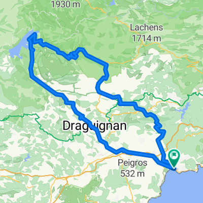
St. Raphael - Esterel-Gebirge (Pic de l'Ours)
A cycling route starting in Saint-Raphaël, Provence-Alpes-Côte d'Azur Region, France.
Overview
About this route
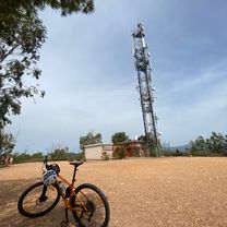
schönster Küstenabschnitt der Cote d'Azur
- -:--
- Duration
- 42.9 km
- Distance
- 627 m
- Ascent
- 637 m
- Descent
- ---
- Avg. speed
- ---
- Avg. speed

Continue with Bikemap
Use, edit, or download this cycling route
You would like to ride St. Raphael - Esterel-Gebirge (Pic de l'Ours) or customize it for your own trip? Here is what you can do with this Bikemap route:
Free features
- Save this route as favorite or in collections
- Copy & plan your own version of this route
- Sync your route with Garmin or Wahoo
Premium features
Free trial for 3 days, or one-time payment. More about Bikemap Premium.
- Navigate this route on iOS & Android
- Export a GPX / KML file of this route
- Create your custom printout (try it for free)
- Download this route for offline navigation
Discover more Premium features.
Get Bikemap PremiumFrom our community
Other popular routes starting in Saint-Raphaël
 Esterelleküste und -berge
- Distance
- 64 km
- Ascent
- 584 m
- Descent
- 590 m
- Location
- Saint-Raphaël, Provence-Alpes-Côte d'Azur Region, France
 Tour du Mont Vinaigre
- Distance
- 17.4 km
- Ascent
- 436 m
- Descent
- 78 m
- Location
- Saint-Raphaël, Provence-Alpes-Côte d'Azur Region, France
 taka góra we Francji
- Distance
- 2.8 km
- Ascent
- 115 m
- Descent
- 113 m
- Location
- Saint-Raphaël, Provence-Alpes-Côte d'Azur Region, France
 Esterel2
- Distance
- 35.8 km
- Ascent
- 550 m
- Descent
- 550 m
- Location
- Saint-Raphaël, Provence-Alpes-Côte d'Azur Region, France
 DE LA MER AUX PREMIERS CONTREFORTS…
- Distance
- 69.1 km
- Ascent
- 486 m
- Descent
- 486 m
- Location
- Saint-Raphaël, Provence-Alpes-Côte d'Azur Region, France
 Von Boulouris über Tanneron über die Corniche zurück
- Distance
- 84.8 km
- Ascent
- 2,479 m
- Descent
- 2,466 m
- Location
- Saint-Raphaël, Provence-Alpes-Côte d'Azur Region, France
 St. Raphael - Lac. St. Chroix
- Distance
- 194.3 km
- Ascent
- 2,128 m
- Descent
- 2,132 m
- Location
- Saint-Raphaël, Provence-Alpes-Côte d'Azur Region, France
 les caous
- Distance
- 16.1 km
- Ascent
- 479 m
- Descent
- 491 m
- Location
- Saint-Raphaël, Provence-Alpes-Côte d'Azur Region, France
Open it in the app