

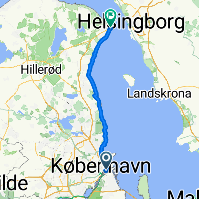
AIb2019 loop B: Along the water
A cycling route starting in Christianshavn, Capital Region, Denmark.
Overview
About this route
I built this route for the AIB conference. Two pieces of general advice for cycling in Denmark: 1) Stay on the right side of the cycle path to allow overtaking and 2) Use your hands to indicate you want to stop or change directions.
Start at Nyhavn and cross the foot/cycle bridge. At the end take a left across the bridge, staying close to the water and passing the Opera (to your left). Turn right at Fabriksmestervej, then immediately left at Dannesjold-Samsøes Alle. Follow the road through several curves. You are passing Noma, one of the world's top restaurants. Turn left following Reshalevej. Near the end of this road follow the signs for 'Reffen', a great open air food court on the water. It is worth stopping here for a drink or some food. Turn back along Refshalevej, taking a right towards Noma. Immediately after Noma turn left (confusingly still called Resfhalevej). You are at the back of Christiania (a 'Free State' within Copenhagen). Take a left onto Prinsesse Gade, then a left at Torvegade (a busy street in the middle of Christianshavn, one of Copenhagen's oldest areas). Take a right to follow the water (Ved Stadsgraven). Stay on the right hand side (Ved Langebro) as you approach a major bridge to go under the bridge, taking a left at the water, onto Islands Brygge. Continue along the water here, until you see a foot / bicycle bridge. Take a right to cross on this bridge (aptly name 'bicycle snake', as it is not 100% straight). At the end take a right into Kalvebod Brygge. You now continue to follow the water in the other direction for a while, passing among others the design museum and national library. At havnegade take a right. At the end of this street you have returned to Nyhavn.
- -:--
- Duration
- 13.3 km
- Distance
- 26 m
- Ascent
- 26 m
- Descent
- ---
- Avg. speed
- ---
- Avg. speed

Route quality
Waytypes & surfaces along the route
Waytypes
Road
3.6 km
(27 %)
Quiet road
3.2 km
(24 %)
Surfaces
Paved
12.5 km
(95 %)
Unpaved
0.2 km
(2 %)
Asphalt
12.1 km
(91 %)
Paving stones
0.3 km
(3 %)
Continue with Bikemap
Use, edit, or download this cycling route
You would like to ride AIb2019 loop B: Along the water or customize it for your own trip? Here is what you can do with this Bikemap route:
Free features
- Save this route as favorite or in collections
- Copy & plan your own version of this route
- Sync your route with Garmin or Wahoo
Premium features
Free trial for 3 days, or one-time payment. More about Bikemap Premium.
- Navigate this route on iOS & Android
- Export a GPX / KML file of this route
- Create your custom printout (try it for free)
- Download this route for offline navigation
Discover more Premium features.
Get Bikemap PremiumFrom our community
Other popular routes starting in Christianshavn
 Galionsvej, København K nach Galionsvej, København K
- Distance
- 5.2 km
- Ascent
- 44 m
- Descent
- 46 m
- Location
- Christianshavn, Capital Region, Denmark
 Radkurs Challenge Copenhagen 2010
- Distance
- 101.7 km
- Ascent
- 149 m
- Descent
- 143 m
- Location
- Christianshavn, Capital Region, Denmark
 Copenhagen-Helsingør 48km ENG 2025
- Distance
- 49.9 km
- Ascent
- 180 m
- Descent
- 179 m
- Location
- Christianshavn, Capital Region, Denmark
 Amager route
- Distance
- 27.2 km
- Ascent
- 34 m
- Descent
- 33 m
- Location
- Christianshavn, Capital Region, Denmark
 Dänemark 2017 - CPH Loop
- Distance
- 305.9 km
- Ascent
- 325 m
- Descent
- 326 m
- Location
- Christianshavn, Capital Region, Denmark
 Halvmarton
- Distance
- 21.7 km
- Ascent
- 52 m
- Descent
- 53 m
- Location
- Christianshavn, Capital Region, Denmark
 Copenhagen e la costa svedese
- Distance
- 374.8 km
- Ascent
- 373 m
- Descent
- 373 m
- Location
- Christianshavn, Capital Region, Denmark
![Amager tour [mod]](https://media.bikemap.net/routes/7385546/staticmaps/in_610f8787-eccb-4f5a-b036-385b311fe608_400x400_bikemap-2021-3D-static.png) Amager tour [mod]
Amager tour [mod]- Distance
- 39.9 km
- Ascent
- 24 m
- Descent
- 23 m
- Location
- Christianshavn, Capital Region, Denmark
Open it in the app