
07_Rothenburg_Schwarzach am Main
A cycling route starting in Rothenburg upon Tauber, Bavaria, Germany.
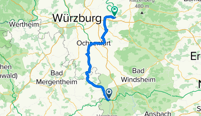
Overview
About this route
Gefahren am 23. August 2019. Von Rothenburg entlang der Romantischen Straße bis Biberehen, weiter entlang der Bahntrasse Gautal Radweg , 5 Sterne. Ab Ochsenfurt bis Markbreit sehr lieblos angelegt, ab Marktbreit bis Kitzingen gutes Verhältnisse, ab Kitzingen habe ich das linke Ufer genommen, sehr schönes Radfahren bis Schwarzach am Main.
Achtung Bikemap.net erkennt nicht die GPS Daten des Gautal Radweg.
- -:--
- Duration
- 72.4 km
- Distance
- 178 m
- Ascent
- 420 m
- Descent
- ---
- Avg. speed
- ---
- Avg. speed

Route quality
Waytypes & surfaces along the route
Waytypes
Path
23.2 km
(32 %)
Track
17.6 km
(24 %)
Surfaces
Paved
59.6 km
(82 %)
Unpaved
1.9 km
(3 %)
Asphalt
59.6 km
(82 %)
Gravel
1 km
(1 %)
Continue with Bikemap
Use, edit, or download this cycling route
You would like to ride 07_Rothenburg_Schwarzach am Main or customize it for your own trip? Here is what you can do with this Bikemap route:
Free features
- Save this route as favorite or in collections
- Copy & plan your own version of this route
- Sync your route with Garmin or Wahoo
Premium features
Free trial for 3 days, or one-time payment. More about Bikemap Premium.
- Navigate this route on iOS & Android
- Export a GPX / KML file of this route
- Create your custom printout (try it for free)
- Download this route for offline navigation
Discover more Premium features.
Get Bikemap PremiumFrom our community
Other popular routes starting in Rothenburg upon Tauber
 altmühltal
- Distance
- 137.4 km
- Ascent
- 496 m
- Descent
- 540 m
- Location
- Rothenburg upon Tauber, Bavaria, Germany
 35_Rothenburg ob der Tauber – Leutershausen
- Distance
- 41.9 km
- Ascent
- 171 m
- Descent
- 168 m
- Location
- Rothenburg upon Tauber, Bavaria, Germany
 Rund um Rothenburg
- Distance
- 23.1 km
- Ascent
- 463 m
- Descent
- 445 m
- Location
- Rothenburg upon Tauber, Bavaria, Germany
 Rothenburg to Bamberg
- Distance
- 120.8 km
- Ascent
- 98 m
- Descent
- 285 m
- Location
- Rothenburg upon Tauber, Bavaria, Germany
 Rothenburg Burgbernheim Runde
- Distance
- 30.5 km
- Ascent
- 266 m
- Descent
- 275 m
- Location
- Rothenburg upon Tauber, Bavaria, Germany
 Taubertal-Panorama
- Distance
- 52.4 km
- Ascent
- 733 m
- Descent
- 895 m
- Location
- Rothenburg upon Tauber, Bavaria, Germany
 Rothenburg-Tauberquelle
- Distance
- 44.7 km
- Ascent
- 278 m
- Descent
- 278 m
- Location
- Rothenburg upon Tauber, Bavaria, Germany
 Altmühlradweg: Rothenburg-Kelheim
- Distance
- 244.8 km
- Ascent
- 316 m
- Descent
- 400 m
- Location
- Rothenburg upon Tauber, Bavaria, Germany
Open it in the app