

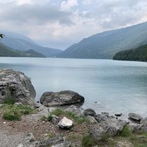
6. Molveno -- Torbole
A cycling route starting in Molveno, Trentino-Alto Adige, Italy.
Overview
About this route
Erst 500 Auf Aber dann 1350 Abwärts
- -:--
- Duration
- 50 km
- Distance
- 580 m
- Ascent
- 1,363 m
- Descent
- ---
- Avg. speed
- ---
- Avg. speed

Route quality
Waytypes & surfaces along the route
Waytypes
Cycleway
13.6 km
(27 %)
Quiet road
13.3 km
(27 %)
Surfaces
Paved
36.2 km
(72 %)
Unpaved
6.6 km
(13 %)
Asphalt
32.1 km
(64 %)
Gravel
4.9 km
(10 %)
Continue with Bikemap
Use, edit, or download this cycling route
You would like to ride 6. Molveno -- Torbole or customize it for your own trip? Here is what you can do with this Bikemap route:
Free features
- Save this route as favorite or in collections
- Copy & plan your own version of this route
- Sync your route with Garmin or Wahoo
Premium features
Free trial for 3 days, or one-time payment. More about Bikemap Premium.
- Navigate this route on iOS & Android
- Export a GPX / KML file of this route
- Create your custom printout (try it for free)
- Download this route for offline navigation
Discover more Premium features.
Get Bikemap PremiumFrom our community
Other popular routes starting in Molveno
 Molveno - Riva
- Distance
- 43.1 km
- Ascent
- 500 m
- Descent
- 1,282 m
- Location
- Molveno, Trentino-Alto Adige, Italy
 molveno riva del Garda and back
- Distance
- 92.8 km
- Ascent
- 1,511 m
- Descent
- 1,511 m
- Location
- Molveno, Trentino-Alto Adige, Italy
 Bear trail_Modificato
- Distance
- 46.3 km
- Ascent
- 3,030 m
- Descent
- 3,033 m
- Location
- Molveno, Trentino-Alto Adige, Italy
 788 "A.d.Scudelle MTB"
- Distance
- 20.2 km
- Ascent
- 679 m
- Descent
- 682 m
- Location
- Molveno, Trentino-Alto Adige, Italy
 giro molveno
- Distance
- 140.4 km
- Ascent
- 2,365 m
- Descent
- 2,365 m
- Location
- Molveno, Trentino-Alto Adige, Italy
 Giro a velocità lenta in Terlago
- Distance
- 21.8 km
- Ascent
- 0 m
- Descent
- 0 m
- Location
- Molveno, Trentino-Alto Adige, Italy
 molveno round
- Distance
- 11 km
- Ascent
- 117 m
- Descent
- 116 m
- Location
- Molveno, Trentino-Alto Adige, Italy
 Rifugio La Montanara - trekking
- Distance
- 8.3 km
- Ascent
- 705 m
- Descent
- 640 m
- Location
- Molveno, Trentino-Alto Adige, Italy
Open it in the app