

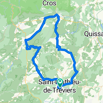
St-Mathieu de Treviers - Marseillette
A cycling route starting in Saint-Mathieu-de-Tréviers, Occitanie, France.
Overview
About this route
Route effectuée et importée depuis Strava
- -:--
- Duration
- 199.6 km
- Distance
- 152 m
- Ascent
- 172 m
- Descent
- ---
- Avg. speed
- ---
- Max. altitude

Route quality
Waytypes & surfaces along the route
Waytypes
Cycleway
56.5 km
(28 %)
Quiet road
37.2 km
(19 %)
Surfaces
Paved
113 km
(57 %)
Unpaved
42.6 km
(21 %)
Asphalt
108 km
(54 %)
Gravel
26 km
(13 %)
Continue with Bikemap
Use, edit, or download this cycling route
You would like to ride St-Mathieu de Treviers - Marseillette or customize it for your own trip? Here is what you can do with this Bikemap route:
Free features
- Save this route as favorite or in collections
- Copy & plan your own version of this route
- Split it into stages to create a multi-day tour
- Sync your route with Garmin or Wahoo
Premium features
Free trial for 3 days, or one-time payment. More about Bikemap Premium.
- Navigate this route on iOS & Android
- Export a GPX / KML file of this route
- Create your custom printout (try it for free)
- Download this route for offline navigation
Discover more Premium features.
Get Bikemap PremiumFrom our community
Other popular routes starting in Saint-Mathieu-de-Tréviers
 MTB 22. Prades-le-Lez 40km
- Distance
- 31.8 km
- Ascent
- 369 m
- Descent
- 388 m
- Location
- Saint-Mathieu-de-Tréviers, Occitanie, France
 PIC SAINT LOUP PAR LA BUEGE
- Distance
- 77 km
- Ascent
- 967 m
- Descent
- 967 m
- Location
- Saint-Mathieu-de-Tréviers, Occitanie, France
 Parcours N7
- Distance
- 76 km
- Ascent
- 654 m
- Descent
- 654 m
- Location
- Saint-Mathieu-de-Tréviers, Occitanie, France
 Nord West Saint Mathieu
- Distance
- 67.9 km
- Ascent
- 231 m
- Descent
- 231 m
- Location
- Saint-Mathieu-de-Tréviers, Occitanie, France
 03. St Mathieu Notre Dame de Londres
- Distance
- 29.6 km
- Ascent
- 431 m
- Descent
- 345 m
- Location
- Saint-Mathieu-de-Tréviers, Occitanie, France
 valflaunés
- Distance
- 37.1 km
- Ascent
- 541 m
- Descent
- 542 m
- Location
- Saint-Mathieu-de-Tréviers, Occitanie, France
 MTB 08. Autour de Saint Mathieu
- Distance
- 28.3 km
- Ascent
- 434 m
- Descent
- 431 m
- Location
- Saint-Mathieu-de-Tréviers, Occitanie, France
 22 juin 2014_sortie MUC Montpellier Cyclo
- Distance
- 83.2 km
- Ascent
- 1,095 m
- Descent
- 1,094 m
- Location
- Saint-Mathieu-de-Tréviers, Occitanie, France
Open it in the app