

Main Yarra Trail
A cycling route starting in Southbank, Victoria, Australia.
Overview
About this route
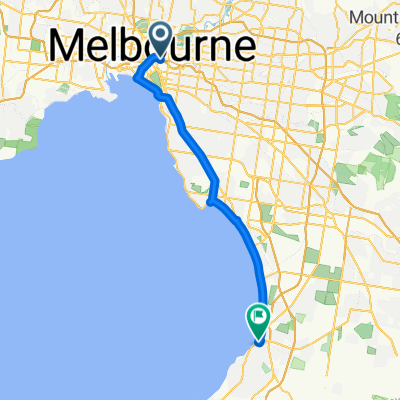
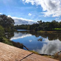
The Main Yarra Trail brings you from the city of Melbourne to Eltham. Most of the trial is off-road, but smooth and pretty flat. There are a lot of stops to be found to relax and rest along the way - perfect for a day trip!
- -:--
- Duration
- 38.8 km
- Distance
- 179 m
- Ascent
- 156 m
- Descent
- ---
- Avg. speed
- ---
- Avg. speed
Route quality
Waytypes & surfaces along the route
Waytypes
Cycleway
36.9 km
(95 %)
Access road
0.6 km
(2 %)
Surfaces
Paved
32.6 km
(84 %)
Unpaved
5.2 km
(13 %)
Asphalt
18 km
(46 %)
Concrete
7.7 km
(20 %)
Continue with Bikemap
Use, edit, or download this cycling route
You would like to ride Main Yarra Trail or customize it for your own trip? Here is what you can do with this Bikemap route:
Free features
- Save this route as favorite or in collections
- Copy & plan your own version of this route
- Sync your route with Garmin or Wahoo
Premium features
Free trial for 3 days, or one-time payment. More about Bikemap Premium.
- Navigate this route on iOS & Android
- Export a GPX / KML file of this route
- Create your custom printout (try it for free)
- Download this route for offline navigation
Discover more Premium features.
Get Bikemap PremiumFrom our community
Other popular routes starting in Southbank
 Anniversary Trail Circuit
- Distance
- 36.5 km
- Ascent
- 0 m
- Descent
- 0 m
- Location
- Southbank, Victoria, Australia
 Frankston Route
- Distance
- 46.5 km
- Ascent
- 96 m
- Descent
- 79 m
- Location
- Southbank, Victoria, Australia
 Federation Square to Valley Lake Loop
- Distance
- 40.4 km
- Ascent
- 95 m
- Descent
- 100 m
- Location
- Southbank, Victoria, Australia
 Southbank to Gardener creek trail
- Distance
- 22.2 km
- Ascent
- 149 m
- Descent
- 145 m
- Location
- Southbank, Victoria, Australia
 ATW Pt.3
- Distance
- 9,039.1 km
- Ascent
- 2,941 m
- Descent
- 2,940 m
- Location
- Southbank, Victoria, Australia
 Easy yarra route from Kew to SOuthgateto
- Distance
- 12 km
- Ascent
- 133 m
- Descent
- 129 m
- Location
- Southbank, Victoria, Australia
 Capital City Trail
- Distance
- 34.5 km
- Ascent
- 281 m
- Descent
- 271 m
- Location
- Southbank, Victoria, Australia
 Federation Square to Ashburton Loop
- Distance
- 30 km
- Ascent
- 94 m
- Descent
- 94 m
- Location
- Southbank, Victoria, Australia
Open it in the app