

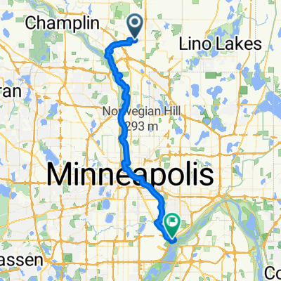
B2B00445 55449>55128 via Radisson Rd, Lexington Ave, Victoria St, Edgerton St, Gateway Trl, 40th St N
A cycling route starting in Blaine, Minnesota, United States of America.
Overview
About this route
Many roads have bike paths next to them in addition to a shoulder.
The 262 runs from Blaine to St. Paul.
- -:--
- Duration
- 25.2 km
- Distance
- 61 m
- Ascent
- 63 m
- Descent
- ---
- Avg. speed
- 302 m
- Avg. speed
Route quality
Waytypes & surfaces along the route
Waytypes
Road
10.7 km
(42 %)
Cycleway
7 km
(28 %)
Surfaces
Paved
12.7 km
(51 %)
Asphalt
11.7 km
(46 %)
Paved (undefined)
0.6 km
(2 %)
Continue with Bikemap
Use, edit, or download this cycling route
You would like to ride B2B00445 55449>55128 via Radisson Rd, Lexington Ave, Victoria St, Edgerton St, Gateway Trl, 40th St N or customize it for your own trip? Here is what you can do with this Bikemap route:
Free features
- Save this route as favorite or in collections
- Copy & plan your own version of this route
- Sync your route with Garmin or Wahoo
Premium features
Free trial for 3 days, or one-time payment. More about Bikemap Premium.
- Navigate this route on iOS & Android
- Export a GPX / KML file of this route
- Create your custom printout (try it for free)
- Download this route for offline navigation
Discover more Premium features.
Get Bikemap PremiumFrom our community
Other popular routes starting in Blaine
 B2B00605 55449>55416 via 117th Av NE, Egret Blvd, Regent Av, 63rd Av, Boone Av, Glenwood Av
- Distance
- 41.1 km
- Ascent
- 85 m
- Descent
- 85 m
- Location
- Blaine, Minnesota, United States of America
 B2B00271 55448>55303 via 121st Ave NW, 113th Ave NW, 119th Ave NW
- Distance
- 13.8 km
- Ascent
- 13 m
- Descent
- 22 m
- Location
- Blaine, Minnesota, United States of America
 B2B00446 55449>55101 via Radisson Rd, Lexington Av, Victoria St, Como Av
- Distance
- 36.3 km
- Ascent
- 112 m
- Descent
- 131 m
- Location
- Blaine, Minnesota, United States of America
 Bunker Hills Swamp to CR dam
- Distance
- 36.4 km
- Ascent
- 52 m
- Descent
- 52 m
- Location
- Blaine, Minnesota, United States of America
 Blaine to GLS
- Distance
- 29.8 km
- Ascent
- 40 m
- Descent
- 42 m
- Location
- Blaine, Minnesota, United States of America
 Blaine to Stillwater
- Distance
- 49.1 km
- Ascent
- 72 m
- Descent
- 122 m
- Location
- Blaine, Minnesota, United States of America
 10625 Able St NE, Blaine to 10657 Able St NE, Blaine
- Distance
- 17.7 km
- Ascent
- 77 m
- Descent
- 75 m
- Location
- Blaine, Minnesota, United States of America
 Blaine to Fort Snelling
- Distance
- 47 km
- Ascent
- 152 m
- Descent
- 187 m
- Location
- Blaine, Minnesota, United States of America
Open it in the app