

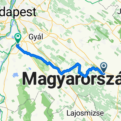
GEOLÁDÁS: Budai út-Cegléd-Zöldhalom-Csemő-Aprajafalva-Hantháza-Mikebuda-Albertirsa-Ceglédbercel-Budai út
A cycling route starting in Ceglédbercel, Pest megye, Hungary.
Overview
About this route
- -:--
- Duration
- 74 km
- Distance
- 89 m
- Ascent
- 91 m
- Descent
- ---
- Avg. speed
- ---
- Avg. speed

Route quality
Waytypes & surfaces along the route
Waytypes
Track
28 km
(38 %)
Busy road
14.5 km
(20 %)
Surfaces
Paved
18.4 km
(25 %)
Unpaved
10.1 km
(14 %)
Asphalt
17.1 km
(23 %)
Ground
6.4 km
(9 %)
Route highlights
Points of interest along the route
Point of interest after 21.7 km
GCPUTE geoláda kb.erre...
Point of interest after 26.8 km
GCSEMO geoláda kb. erre...
Point of interest after 31.9 km
A cikkcakkos rész járhatatlan dzsungel, menj tovább egyenesen...! :)
Point of interest after 32.8 km
GCstha nagyon kb. erre... :-)
Point of interest after 40.7 km
GCHHKK geoláda kb. erre...
Continue with Bikemap
Use, edit, or download this cycling route
You would like to ride GEOLÁDÁS: Budai út-Cegléd-Zöldhalom-Csemő-Aprajafalva-Hantháza-Mikebuda-Albertirsa-Ceglédbercel-Budai út or customize it for your own trip? Here is what you can do with this Bikemap route:
Free features
- Save this route as favorite or in collections
- Copy & plan your own version of this route
- Sync your route with Garmin or Wahoo
Premium features
Free trial for 3 days, or one-time payment. More about Bikemap Premium.
- Navigate this route on iOS & Android
- Export a GPX / KML file of this route
- Create your custom printout (try it for free)
- Download this route for offline navigation
Discover more Premium features.
Get Bikemap PremiumFrom our community
Other popular routes starting in Ceglédbercel
 Restful route in Albertirsa
- Distance
- 2.5 km
- Ascent
- 22 m
- Descent
- 19 m
- Location
- Ceglédbercel, Pest megye, Hungary
 Csemő-Mikebuda
- Distance
- 45.7 km
- Ascent
- 64 m
- Descent
- 64 m
- Location
- Ceglédbercel, Pest megye, Hungary
 Ceglédbercel-Budai út-Cegléd-Csemő-Hantháza-Pusztavacs-Dánszentmiklós-Albertirsa-Bercelcity
- Distance
- 67 km
- Ascent
- 87 m
- Descent
- 87 m
- Location
- Ceglédbercel, Pest megye, Hungary
 Alap_1
- Distance
- 28.8 km
- Ascent
- 49 m
- Descent
- 49 m
- Location
- Ceglédbercel, Pest megye, Hungary
 GEOLÁDÁS: Budai út-Cegléd-Zöldhalom-Csemő-Aprajafalva-Hantháza-Mikebuda-Albertirsa-Ceglédbercel-Budai út
- Distance
- 74 km
- Ascent
- 89 m
- Descent
- 91 m
- Location
- Ceglédbercel, Pest megye, Hungary
 Erdész utca 10., Cegléd nach Almavirág utca 3., Kecskemét
- Distance
- 61.4 km
- Ascent
- 58 m
- Descent
- 48 m
- Location
- Ceglédbercel, Pest megye, Hungary
 Ceglédbercel - Dabas
- Distance
- 43.7 km
- Ascent
- 45 m
- Descent
- 74 m
- Location
- Ceglédbercel, Pest megye, Hungary
 szep14
- Distance
- 70.3 km
- Ascent
- 30 m
- Descent
- 70 m
- Location
- Ceglédbercel, Pest megye, Hungary
Open it in the app