
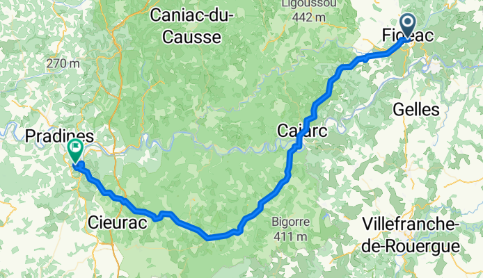
Jakobsweg Etappe 9 - Via Podiensis: Figeac - Cahors GR 65
A cycling route starting in Figeac, Languedoc-Roussillon-Midi-Pyrénées, France.
Overview
About this route
Entlang des GR 65 - Dolmenroute: Unesco Kulturerbe mit Dolmen aus der Megalithkultur
- -:--
- Duration
- 76.9 km
- Distance
- 630 m
- Ascent
- 709 m
- Descent
- ---
- Avg. speed
- ---
- Avg. speed
Route quality
Waytypes & surfaces along the route
Waytypes
Busy road
49 km
(64 %)
Road
19.5 km
(25 %)
Surfaces
Paved
34.4 km
(45 %)
Unpaved
0.4 km
(<1 %)
Asphalt
34.2 km
(44 %)
Paving stones
0.2 km
(<1 %)
Route highlights
Points of interest along the route
Point of interest after 25.9 km
Camping Municipal Plan d'Eau
Point of interest after 37.1 km
Camping Municipal
Point of interest after 51.6 km
Camping
Point of interest after 75 km
Caming Rivière de Capessut
Continue with Bikemap
Use, edit, or download this cycling route
You would like to ride Jakobsweg Etappe 9 - Via Podiensis: Figeac - Cahors GR 65 or customize it for your own trip? Here is what you can do with this Bikemap route:
Free features
- Save this route as favorite or in collections
- Copy & plan your own version of this route
- Sync your route with Garmin or Wahoo
Premium features
Free trial for 3 days, or one-time payment. More about Bikemap Premium.
- Navigate this route on iOS & Android
- Export a GPX / KML file of this route
- Create your custom printout (try it for free)
- Download this route for offline navigation
Discover more Premium features.
Get Bikemap PremiumFrom our community
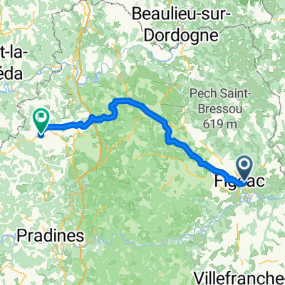
Other popular routes starting in Figeac
 lot 1
lot 1- Distance
- 28.7 km
- Ascent
- 322 m
- Descent
- 415 m
- Location
- Figeac, Languedoc-Roussillon-Midi-Pyrénées, France
 DAG 7 18 JULY 2019 Figeac - Gourdon Camping Le Paradis
- Distance
- 80.8 km
- Ascent
- 752 m
- Descent
- 701 m
- Location
- Figeac, Languedoc-Roussillon-Midi-Pyrénées, France
 Figaec - Bordeaux
- Distance
- 280.4 km
- Ascent
- 252 m
- Descent
- 445 m
- Location
- Figeac, Languedoc-Roussillon-Midi-Pyrénées, France
 J.11a Figeac - Toulose
- Distance
- 169.1 km
- Ascent
- 663 m
- Descent
- 782 m
- Location
- Figeac, Languedoc-Roussillon-Midi-Pyrénées, France
 Figeac > Vers
- Distance
- 68.3 km
- Ascent
- 540 m
- Descent
- 620 m
- Location
- Figeac, Languedoc-Roussillon-Midi-Pyrénées, France
 2023 9 - Figeac à Rodez - 66,1km 800D+
- Distance
- 65.9 km
- Ascent
- 990 m
- Descent
- 665 m
- Location
- Figeac, Languedoc-Roussillon-Midi-Pyrénées, France
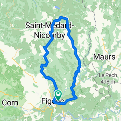 DAG 6 17 JULY 2019 Rondrit Figeac -Figeac
- Distance
- 68.5 km
- Ascent
- 853 m
- Descent
- 849 m
- Location
- Figeac, Languedoc-Roussillon-Midi-Pyrénées, France
 Figeac-Puy-L'Eveque
- Distance
- 127 km
- Ascent
- 1,843 m
- Descent
- 1,921 m
- Location
- Figeac, Languedoc-Roussillon-Midi-Pyrénées, France
Open it in the app