

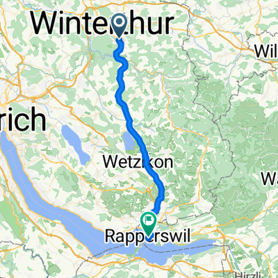
Seen-RundFlugahfen-Seen😉
A cycling route starting in Seen (Kreis 3) / Büelwiesen, Canton of Zurich, Switzerland.
Overview
About this route
- 2 h 8 min
- Duration
- 55.3 km
- Distance
- 739 m
- Ascent
- 743 m
- Descent
- 26 km/h
- Avg. speed
- ---
- Avg. speed

Route quality
Waytypes & surfaces along the route
Waytypes
Busy road
24.7 km
(45 %)
Path
9 km
(16 %)
Surfaces
Paved
52.7 km
(95 %)
Unpaved
0.4 km
(<1 %)
Asphalt
51.9 km
(94 %)
Concrete
0.7 km
(1 %)
Continue with Bikemap
Use, edit, or download this cycling route
You would like to ride Seen-RundFlugahfen-Seen😉 or customize it for your own trip? Here is what you can do with this Bikemap route:
Free features
- Save this route as favorite or in collections
- Copy & plan your own version of this route
- Sync your route with Garmin or Wahoo
Premium features
Free trial for 3 days, or one-time payment. More about Bikemap Premium.
- Navigate this route on iOS & Android
- Export a GPX / KML file of this route
- Create your custom printout (try it for free)
- Download this route for offline navigation
Discover more Premium features.
Get Bikemap PremiumFrom our community
Other popular routes starting in Seen (Kreis 3) / Büelwiesen
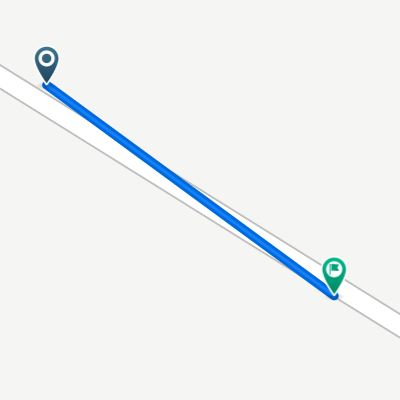
 Winterthur-Rapperswil
- Distance
- 35.1 km
- Ascent
- 384 m
- Descent
- 430 m
- Location
- Seen (Kreis 3) / Büelwiesen, Canton of Zurich, Switzerland
 Bahnhof Seen rund Eschenberg
- Distance
- 16.9 km
- Ascent
- 333 m
- Descent
- 336 m
- Location
- Seen (Kreis 3) / Büelwiesen, Canton of Zurich, Switzerland
 Seen-Ricketwil-Elsau-Bertschikon-Sulz-Dinhard-Dägerlen-Hettlingen-Seuzach-Seen
- Distance
- 33 km
- Ascent
- 307 m
- Descent
- 307 m
- Location
- Seen (Kreis 3) / Büelwiesen, Canton of Zurich, Switzerland
 Bachwiesenstrasse 32, Winterthur nach Stockacher Straße 63, Mühlingen
- Distance
- 65.3 km
- Ascent
- 804 m
- Descent
- 658 m
- Location
- Seen (Kreis 3) / Büelwiesen, Canton of Zurich, Switzerland
 Töss 8
- Distance
- 45.5 km
- Ascent
- 864 m
- Descent
- 864 m
- Location
- Seen (Kreis 3) / Büelwiesen, Canton of Zurich, Switzerland
 Stockemerbergstrasse 1, Winterthur nach Stockemerbergstrasse 1, Winterthur
- Distance
- 0 km
- Ascent
- 0 m
- Descent
- 0 m
- Location
- Seen (Kreis 3) / Büelwiesen, Canton of Zurich, Switzerland
 Wald- und Wiesenrunde
- Distance
- 13.2 km
- Ascent
- 226 m
- Descent
- 208 m
- Location
- Seen (Kreis 3) / Büelwiesen, Canton of Zurich, Switzerland
 Seen-RundFlugahfen-Seen😉
- Distance
- 55.3 km
- Ascent
- 739 m
- Descent
- 743 m
- Location
- Seen (Kreis 3) / Büelwiesen, Canton of Zurich, Switzerland
Open it in the app