

Schneegklöckchen CLONED FROM ROUTE 146180
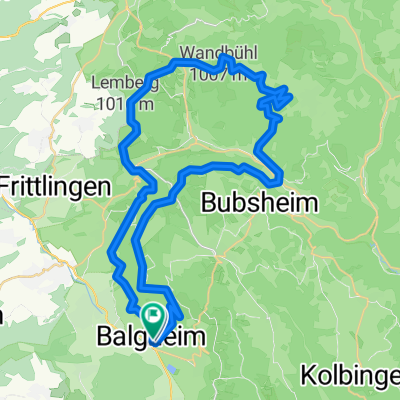
A cycling route starting in Balgheim, Baden-Württemberg, Germany.
Overview
About this route
Beginnt entspannt mit einer Runde zum Klippeneck, gefolgt von Singletrails (Eingang: Schmid Steige, teils selektiv vorallem zu Anfang ) richtung Balgheim, dannach aufwärts zum Tanzplatz, um wieder Abwärts zu kommen. Nach dem kurzen Stück Straße runter auf den oberen Forstweg, die erste links. dannach wieder links (hoch) zum Nadelwald. zurück zur "Stadt"
- -:--
- Duration
- 12.5 km
- Distance
- 248 m
- Ascent
- 557 m
- Descent
- ---
- Avg. speed
- ---
- Avg. speed
Continue with Bikemap
Use, edit, or download this cycling route
You would like to ride Schneegklöckchen CLONED FROM ROUTE 146180 or customize it for your own trip? Here is what you can do with this Bikemap route:
Free features
- Save this route as favorite or in collections
- Copy & plan your own version of this route
- Sync your route with Garmin or Wahoo
Premium features
Free trial for 3 days, or one-time payment. More about Bikemap Premium.
- Navigate this route on iOS & Android
- Export a GPX / KML file of this route
- Create your custom printout (try it for free)
- Download this route for offline navigation
Discover more Premium features.
Get Bikemap PremiumFrom our community
Other popular routes starting in Balgheim
 Balgheim nach Bodman-Ludwigshafen
- Distance
- 46.8 km
- Ascent
- 566 m
- Descent
- 860 m
- Location
- Balgheim, Baden-Württemberg, Germany
 Schloßäckerweg 15, Balgheim nach Dürbheimer Straße 18, Balgheim
- Distance
- 17.3 km
- Ascent
- 477 m
- Descent
- 481 m
- Location
- Balgheim, Baden-Württemberg, Germany
 MB-Tour Heuberg-Tanneck
- Distance
- 50.6 km
- Ascent
- 1,275 m
- Descent
- 1,279 m
- Location
- Balgheim, Baden-Württemberg, Germany
 Unnamed Road, Balgheim nach Unnamed Road, Balgheim
- Distance
- 9.8 km
- Ascent
- 306 m
- Descent
- 308 m
- Location
- Balgheim, Baden-Württemberg, Germany
 Schneegklöckchen CLONED FROM ROUTE 146180
- Distance
- 12.5 km
- Ascent
- 248 m
- Descent
- 557 m
- Location
- Balgheim, Baden-Württemberg, Germany
 Balgheim - Heuberg - Donautal
- Distance
- 72.5 km
- Ascent
- 1,144 m
- Descent
- 1,170 m
- Location
- Balgheim, Baden-Württemberg, Germany
 Talheim-Esslingen-Kohlhalde
- Distance
- 40.2 km
- Ascent
- 677 m
- Descent
- 671 m
- Location
- Balgheim, Baden-Württemberg, Germany
 B14, Balgheim nach Uhldingen-Mühlhofen
- Distance
- 62.8 km
- Ascent
- 566 m
- Descent
- 855 m
- Location
- Balgheim, Baden-Württemberg, Germany
Open it in the app