

Gravel por las Vegas del Sur
A cycling route starting in San Martín de la Vega, Madrid, Spain.
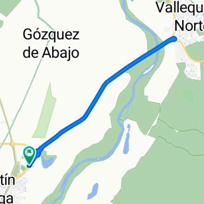
Overview
About this route
- -:--
- Duration
- 100.8 km
- Distance
- 841 m
- Ascent
- 842 m
- Descent
- ---
- Avg. speed
- ---
- Avg. speed
Route quality
Waytypes & surfaces along the route
Waytypes
Track
59.4 km
(59 %)
Busy road
15.5 km
(15 %)
Surfaces
Paved
16.1 km
(16 %)
Unpaved
26 km
(26 %)
Ground
18.1 km
(18 %)
Asphalt
12.3 km
(12 %)
Continue with Bikemap
Use, edit, or download this cycling route
You would like to ride Gravel por las Vegas del Sur or customize it for your own trip? Here is what you can do with this Bikemap route:
Free features
- Save this route as favorite or in collections
- Copy & plan your own version of this route
- Sync your route with Garmin or Wahoo
Premium features
Free trial for 3 days, or one-time payment. More about Bikemap Premium.
- Navigate this route on iOS & Android
- Export a GPX / KML file of this route
- Create your custom printout (try it for free)
- Download this route for offline navigation
Discover more Premium features.
Get Bikemap PremiumFrom our community
Other popular routes starting in San Martín de la Vega
 Parador de Frascuelo
- Distance
- 19 km
- Ascent
- 222 m
- Descent
- 222 m
- Location
- San Martín de la Vega, Madrid, Spain
 San Martin, Ciempozuelos, Aranjuez, Balcon del Tajo, Villaconejos, Titulcia, San Martin
- Distance
- 60.8 km
- Ascent
- 194 m
- Descent
- 193 m
- Location
- San Martín de la Vega, Madrid, Spain
 San Martin, Nueva, Morata, Valdelaguna, Chinchon, Frascuelo, San Martin
- Distance
- 53.1 km
- Ascent
- 614 m
- Descent
- 613 m
- Location
- San Martín de la Vega, Madrid, Spain
 1ª Etapa Vuelta a Madrid Máster 2010 (CRI)
- Distance
- 7.3 km
- Ascent
- 9 m
- Descent
- 10 m
- Location
- San Martín de la Vega, Madrid, Spain
 Vuelta en bicicleta por los altos del Pingarrón desde San Martín de la Vega
- Distance
- 27.3 km
- Ascent
- 262 m
- Descent
- 262 m
- Location
- San Martín de la Vega, Madrid, Spain
 San Martín - Valdemoro
- Distance
- 19.1 km
- Ascent
- 308 m
- Descent
- 209 m
- Location
- San Martín de la Vega, Madrid, Spain
 San Martin de la Vega, Ciempozuelos, Aranjuez, Villaconejos, Titulcia, Yesera, San Martin
- Distance
- 62.5 km
- Ascent
- 256 m
- Descent
- 255 m
- Location
- San Martín de la Vega, Madrid, Spain
 San Matin, Titulcia, Los Molinos, Chinchon, Villaconejos, Titulcia, San Martin
- Distance
- 62.4 km
- Ascent
- 353 m
- Descent
- 352 m
- Location
- San Martín de la Vega, Madrid, Spain
Open it in the app