

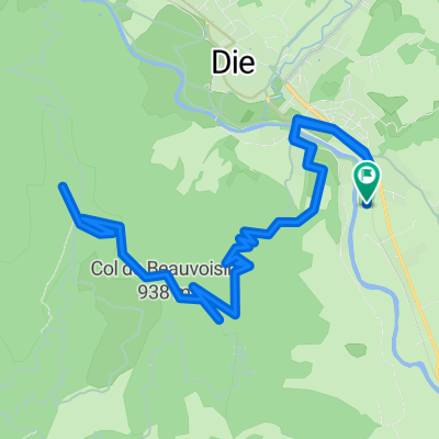
FR_Die_StNazaire_Luc
A cycling route starting in Die, Auvergne-Rhône-Alpes, France.
Overview
About this route
14.08.19 mit Heiko
- -:--
- Duration
- 89.3 km
- Distance
- 1,199 m
- Ascent
- 1,043 m
- Descent
- ---
- Avg. speed
- ---
- Avg. speed

Route quality
Waytypes & surfaces along the route
Waytypes
Busy road
50.4 km
(56 %)
Road
26.7 km
(30 %)
Surfaces
Paved
19.4 km
(22 %)
Unpaved
0.3 km
(<1 %)
Asphalt
17.2 km
(19 %)
Paved (undefined)
2.2 km
(2 %)
Continue with Bikemap
Use, edit, or download this cycling route
You would like to ride FR_Die_StNazaire_Luc or customize it for your own trip? Here is what you can do with this Bikemap route:
Free features
- Save this route as favorite or in collections
- Copy & plan your own version of this route
- Sync your route with Garmin or Wahoo
Premium features
Free trial for 3 days, or one-time payment. More about Bikemap Premium.
- Navigate this route on iOS & Android
- Export a GPX / KML file of this route
- Create your custom printout (try it for free)
- Download this route for offline navigation
Discover more Premium features.
Get Bikemap PremiumFrom our community
Other popular routes starting in Die
 Tour du Glandasse
- Distance
- 32.6 km
- Ascent
- 929 m
- Descent
- 933 m
- Location
- Die, Auvergne-Rhône-Alpes, France
 Die - Die über Croix de Justin
- Distance
- 17.4 km
- Ascent
- 605 m
- Descent
- 604 m
- Location
- Die, Auvergne-Rhône-Alpes, France
 Ouest de Die
- Distance
- 83.5 km
- Ascent
- 858 m
- Descent
- 859 m
- Location
- Die, Auvergne-Rhône-Alpes, France
 Alpentocht 2015 dag 2: Pennes-le-Sec - Grenoble
- Distance
- 105.3 km
- Ascent
- 2,211 m
- Descent
- 1,356 m
- Location
- Die, Auvergne-Rhône-Alpes, France
 Die - Col du Rousset - La Chapelle-en-Vercors 85km-1600m
- Distance
- 84.3 km
- Ascent
- 1,513 m
- Descent
- 1,513 m
- Location
- Die, Auvergne-Rhône-Alpes, France
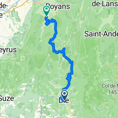 FA13 Die St. Jean en Royans
- Distance
- 61.8 km
- Ascent
- 1,263 m
- Descent
- 1,423 m
- Location
- Die, Auvergne-Rhône-Alpes, France
 Route nach Avenue de la Clairette 90, Die
- Distance
- 40.4 km
- Ascent
- 1,166 m
- Descent
- 1,165 m
- Location
- Die, Auvergne-Rhône-Alpes, France
 2016 Ride Day 89 - Jansac to Valence
- Distance
- 90.1 km
- Ascent
- 177 m
- Descent
- 702 m
- Location
- Die, Auvergne-Rhône-Alpes, France
Open it in the app