

Pielgrzymka dzień 1- 2025
A cycling route starting in Tarnowiec, Subcarpathian Voivodeship, Poland.
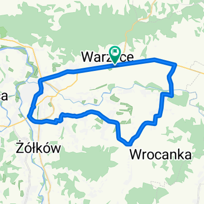
Overview
About this route
- 7 h 29 min
- Duration
- 121.5 km
- Distance
- 570 m
- Ascent
- 640 m
- Descent
- 16.2 km/h
- Avg. speed
- 330 m
- Max. altitude

Route quality
Waytypes & surfaces along the route
Waytypes
Road
61.6 km
(51 %)
Quiet road
39.9 km
(33 %)
Surfaces
Paved
94.2 km
(78 %)
Unpaved
4.9 km
(4 %)
Asphalt
94 km
(77 %)
Ground
4.8 km
(4 %)
Continue with Bikemap
Use, edit, or download this cycling route
You would like to ride Pielgrzymka dzień 1- 2025 or customize it for your own trip? Here is what you can do with this Bikemap route:
Free features
- Save this route as favorite or in collections
- Copy & plan your own version of this route
- Split it into stages to create a multi-day tour
- Sync your route with Garmin or Wahoo
Premium features
Free trial for 3 days, or one-time payment. More about Bikemap Premium.
- Navigate this route on iOS & Android
- Export a GPX / KML file of this route
- Create your custom printout (try it for free)
- Download this route for offline navigation
Discover more Premium features.
Get Bikemap PremiumFrom our community
Other popular routes starting in Tarnowiec
 Jasło - Jasło
- Distance
- 77 km
- Ascent
- 740 m
- Descent
- 734 m
- Location
- Tarnowiec, Subcarpathian Voivodeship, Poland
 rozgrzewka_2023
- Distance
- 48.6 km
- Ascent
- 367 m
- Descent
- 366 m
- Location
- Tarnowiec, Subcarpathian Voivodeship, Poland
 Pielgrzymka dzień 1- 2025
- Distance
- 121.5 km
- Ascent
- 570 m
- Descent
- 640 m
- Location
- Tarnowiec, Subcarpathian Voivodeship, Poland
 dobra trasa
- Distance
- 27.4 km
- Ascent
- 205 m
- Descent
- 205 m
- Location
- Tarnowiec, Subcarpathian Voivodeship, Poland
 Gmina Tarnowiec 2
- Distance
- 23.4 km
- Ascent
- 232 m
- Descent
- 229 m
- Location
- Tarnowiec, Subcarpathian Voivodeship, Poland
 ozenna_23
- Distance
- 98.5 km
- Ascent
- 1,050 m
- Descent
- 1,051 m
- Location
- Tarnowiec, Subcarpathian Voivodeship, Poland
 Punkt widokowy Czarnorzeki
- Distance
- 67.2 km
- Ascent
- 491 m
- Descent
- 494 m
- Location
- Tarnowiec, Subcarpathian Voivodeship, Poland
 Szebnie
- Distance
- 17.8 km
- Ascent
- 96 m
- Descent
- 97 m
- Location
- Tarnowiec, Subcarpathian Voivodeship, Poland
Open it in the app