
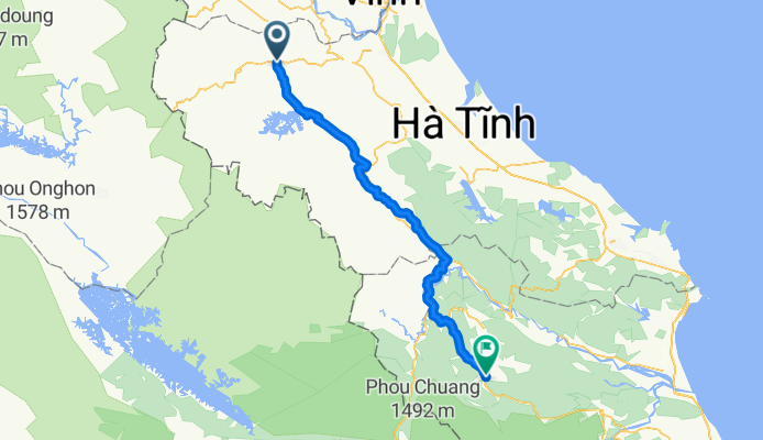
Pho Chau - Trung Hoa
A cycling route starting in Phố Châu, Tỉnh Hà Tĩnh, Vietnam.
Overview
About this route
- -:--
- Duration
- 131.5 km
- Distance
- 486 m
- Ascent
- 316 m
- Descent
- ---
- Avg. speed
- ---
- Avg. speed

Continue with Bikemap
Use, edit, or download this cycling route
You would like to ride Pho Chau - Trung Hoa or customize it for your own trip? Here is what you can do with this Bikemap route:
Free features
- Save this route as favorite or in collections
- Copy & plan your own version of this route
- Sync your route with Garmin or Wahoo
Premium features
Free trial for 3 days, or one-time payment. More about Bikemap Premium.
- Navigate this route on iOS & Android
- Export a GPX / KML file of this route
- Create your custom printout (try it for free)
- Download this route for offline navigation
Discover more Premium features.
Get Bikemap PremiumFrom our community
Other popular routes starting in Phố Châu
 5. Tay Son- Ba Na Hin
- Distance
- 117.9 km
- Ascent
- 1,058 m
- Descent
- 905 m
- Location
- Phố Châu, Tỉnh Hà Tĩnh, Vietnam
 Pho Chao-Da Nang3
- Distance
- 513.2 km
- Ascent
- 460 m
- Descent
- 469 m
- Location
- Phố Châu, Tỉnh Hà Tĩnh, Vietnam
 5. Tay Son - Na Hin (Laos)
- Distance
- 104.7 km
- Ascent
- 944 m
- Descent
- 529 m
- Location
- Phố Châu, Tỉnh Hà Tĩnh, Vietnam
 Pho Chau-Ninh Binh-zurueck 627
- Distance
- 627.6 km
- Ascent
- 609 m
- Descent
- 611 m
- Location
- Phố Châu, Tỉnh Hà Tĩnh, Vietnam
 Vinh - Laos - Quang Binh
- Distance
- 370.2 km
- Ascent
- 2,236 m
- Descent
- 2,242 m
- Location
- Phố Châu, Tỉnh Hà Tĩnh, Vietnam
 Pho Chau - Trung Hoa
- Distance
- 131.5 km
- Ascent
- 486 m
- Descent
- 316 m
- Location
- Phố Châu, Tỉnh Hà Tĩnh, Vietnam
 4. Bai Lu-Tay son
- Distance
- 95.3 km
- Ascent
- 112 m
- Descent
- 90 m
- Location
- Phố Châu, Tỉnh Hà Tĩnh, Vietnam
 Pho Chao-Da Nang2
- Distance
- 602.2 km
- Ascent
- 2,092 m
- Descent
- 2,102 m
- Location
- Phố Châu, Tỉnh Hà Tĩnh, Vietnam
Open it in the app