

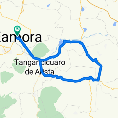
Libramiento Zamora
A cycling route starting in Zamora, Michoacán, Mexico.
Overview
About this route
- 1 h 28 min
- Duration
- 22.6 km
- Distance
- 375 m
- Ascent
- 360 m
- Descent
- 15.5 km/h
- Avg. speed
- ---
- Avg. speed
Continue with Bikemap
Use, edit, or download this cycling route
You would like to ride Libramiento Zamora or customize it for your own trip? Here is what you can do with this Bikemap route:
Free features
- Save this route as favorite or in collections
- Copy & plan your own version of this route
- Sync your route with Garmin or Wahoo
Premium features
Free trial for 3 days, or one-time payment. More about Bikemap Premium.
- Navigate this route on iOS & Android
- Export a GPX / KML file of this route
- Create your custom printout (try it for free)
- Download this route for offline navigation
Discover more Premium features.
Get Bikemap PremiumFrom our community
Other popular routes starting in Zamora
 Circuito 93k Zamora - Purépero de Echáiz - Zamora
- Distance
- 93.9 km
- Ascent
- 602 m
- Descent
- 600 m
- Location
- Zamora, Michoacán, Mexico
 presa de la Luz
- Distance
- 15.6 km
- Ascent
- 363 m
- Descent
- 361 m
- Location
- Zamora, Michoacán, Mexico
 Circuito Zamora - Tangamandapio - Ario - Zamora
- Distance
- 54.2 km
- Ascent
- 241 m
- Descent
- 240 m
- Location
- Zamora, Michoacán, Mexico
 Visita al Compa Victor
- Distance
- 15.7 km
- Ascent
- 237 m
- Descent
- 227 m
- Location
- Zamora, Michoacán, Mexico
 Zamora - San Juan Nuevo 2009
- Distance
- 96 km
- Ascent
- 1,486 m
- Descent
- 1,158 m
- Location
- Zamora, Michoacán, Mexico
 Circuito Zamora - Jacona - Platanal - Zamora
- Distance
- 22.3 km
- Ascent
- 194 m
- Descent
- 191 m
- Location
- Zamora, Michoacán, Mexico
 Zamora - Patzcuaro
- Distance
- 136.8 km
- Ascent
- 1,313 m
- Descent
- 790 m
- Location
- Zamora, Michoacán, Mexico
 Circuito Zamora-Tangamandapio-Tarecuato-Zamora
- Distance
- 71.6 km
- Ascent
- 821 m
- Descent
- 817 m
- Location
- Zamora, Michoacán, Mexico
Open it in the app