
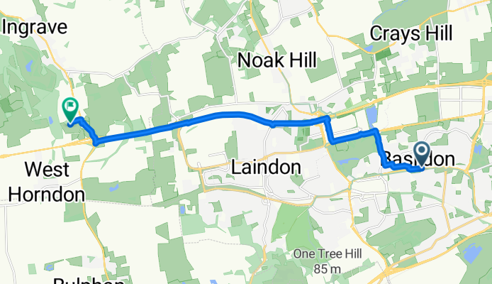
BasThorn
A cycling route starting in Basildon, England, United Kingdom.
Overview
About this route
- -:--
- Duration
- 10.6 km
- Distance
- 60 m
- Ascent
- 43 m
- Descent
- ---
- Avg. speed
- ---
- Avg. speed

Continue with Bikemap
Use, edit, or download this cycling route
You would like to ride BasThorn or customize it for your own trip? Here is what you can do with this Bikemap route:
Free features
- Save this route as favorite or in collections
- Copy & plan your own version of this route
- Sync your route with Garmin or Wahoo
Premium features
Free trial for 3 days, or one-time payment. More about Bikemap Premium.
- Navigate this route on iOS & Android
- Export a GPX / KML file of this route
- Create your custom printout (try it for free)
- Download this route for offline navigation
Discover more Premium features.
Get Bikemap PremiumFrom our community
Other popular routes starting in Basildon
 Slow ride in United Kingdom
- Distance
- 34.9 km
- Ascent
- 240 m
- Descent
- 241 m
- Location
- Basildon, England, United Kingdom
 BasThorn
- Distance
- 10.6 km
- Ascent
- 60 m
- Descent
- 43 m
- Location
- Basildon, England, United Kingdom
 to drunkle
- Distance
- 55.6 km
- Ascent
- 263 m
- Descent
- 216 m
- Location
- Basildon, England, United Kingdom
 87 Clickett Hill, Basildon to 34 Clickett Hill, Basildon
- Distance
- 53.8 km
- Ascent
- 230 m
- Descent
- 230 m
- Location
- Basildon, England, United Kingdom
 Curling Tye 138 to Curling Tye 138
- Distance
- 23.5 km
- Ascent
- 44 m
- Descent
- 45 m
- Location
- Basildon, England, United Kingdom
 UniUel
- Distance
- 36.8 km
- Ascent
- 137 m
- Descent
- 163 m
- Location
- Basildon, England, United Kingdom
 Hoover Drive to Whitmore Way 147
- Distance
- 7.3 km
- Ascent
- 57 m
- Descent
- 68 m
- Location
- Basildon, England, United Kingdom
 1–7 The Hatherley, Fryerns, Basildon to 1–7 The Hatherley, Fryerns, Basildon
- Distance
- 11 km
- Ascent
- 50 m
- Descent
- 49 m
- Location
- Basildon, England, United Kingdom
Open it in the app