

Závěrečná vyjížďka 2019
A cycling route starting in Varnsdorf, Ústecký kraj, Czechia.
Overview
About this route
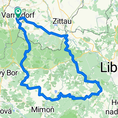
Trasa pro zdatné bikery(ky) z Herrenvalde po "kraličí zelené stezce" ;) Pro ostatní po asfaltu přes Mýto.
- -:--
- Duration
- 44.5 km
- Distance
- 487 m
- Ascent
- 488 m
- Descent
- ---
- Avg. speed
- ---
- Avg. speed

Route quality
Waytypes & surfaces along the route
Waytypes
Track
18.8 km
(42 %)
Quiet road
9.5 km
(21 %)
Surfaces
Paved
15.8 km
(36 %)
Unpaved
14 km
(31 %)
Asphalt
12.4 km
(28 %)
Gravel
8.6 km
(19 %)
Route highlights
Points of interest along the route
Point of interest after 0.7 km
SKLENÍK
Point of interest after 4.6 km
Začátek "kraličí zelené stezky"
Point of interest after 11.3 km
Konec "kraličí zelené stezky"
Point of interest after 11.9 km
Nádražní restaurace Jedlová
Point of interest after 24.6 km
Hotel Jeff
Point of interest after 31.9 km
Křinický pivovar
Point of interest after 42.1 km
Pivovar Kocour
Continue with Bikemap
Use, edit, or download this cycling route
You would like to ride Závěrečná vyjížďka 2019 or customize it for your own trip? Here is what you can do with this Bikemap route:
Free features
- Save this route as favorite or in collections
- Copy & plan your own version of this route
- Sync your route with Garmin or Wahoo
Premium features
Free trial for 3 days, or one-time payment. More about Bikemap Premium.
- Navigate this route on iOS & Android
- Export a GPX / KML file of this route
- Create your custom printout (try it for free)
- Download this route for offline navigation
Discover more Premium features.
Get Bikemap PremiumFrom our community
Other popular routes starting in Varnsdorf
 Na Obere Schleuse II
- Distance
- 66.2 km
- Ascent
- 573 m
- Descent
- 573 m
- Location
- Varnsdorf, Ústecký kraj, Czechia
 Na mlýny u Zábrdky
- Distance
- 127.6 km
- Ascent
- 961 m
- Descent
- 965 m
- Location
- Varnsdorf, Ústecký kraj, Czechia
 20170326_140233.gpx
- Distance
- 31 km
- Ascent
- 260 m
- Descent
- 260 m
- Location
- Varnsdorf, Ústecký kraj, Czechia
 Tanečnice přes prameny Mandavy a osadu Kopec
- Distance
- 60.8 km
- Ascent
- 579 m
- Descent
- 579 m
- Location
- Varnsdorf, Ústecký kraj, Czechia
 Na Děvín
- Distance
- 108.2 km
- Ascent
- 1,049 m
- Descent
- 1,043 m
- Location
- Varnsdorf, Ústecký kraj, Czechia
 Na rozhledny v Německu IV.
- Distance
- 95.2 km
- Ascent
- 571 m
- Descent
- 562 m
- Location
- Varnsdorf, Ústecký kraj, Czechia
 2011-07-16 Harthau-Jeschken-Südumfahrung-Bedrichov-Isergebirge
- Distance
- 143.1 km
- Ascent
- 1,785 m
- Descent
- 1,789 m
- Location
- Varnsdorf, Ústecký kraj, Czechia
 Výlet na Hrazený a Tanečnici
- Distance
- 63.9 km
- Ascent
- 631 m
- Descent
- 629 m
- Location
- Varnsdorf, Ústecký kraj, Czechia
Open it in the app