

Grantham Canal Towpath Off Road
A cycling route starting in Barrowby, England, United Kingdom.
Overview
About this route
This is a delightful little ride along one of the nation's oldest canals. The surfaces are usually firm and it's as flat as a pancake. The route starts at the Meres Leisure Centre and uses all shared cycle paths next to the road. Take care crossing two roads and please be courteous and considerate to other towpath users. It's safest to dismount when passing under bridges, especially as you wil be looking for the 18th century grafitti and marks made by the constant rubbing of tow ropes on the bridge stone. Also, see if you can find the stream that runs under the canal. If you are feeling like it, you can continue all the way to the Dirty Duck pub for a well deserved refreshment. As there are narrow gates at the entrance to the towpath this route is not suitable for trikes and recumbents, unless you have help to lift them over.
- -:--
- Duration
- 9.3 km
- Distance
- 26 m
- Ascent
- 63 m
- Descent
- ---
- Avg. speed
- ---
- Avg. speed

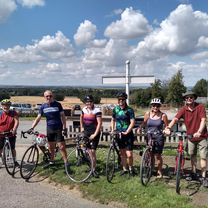
Route photos

Route quality
Waytypes & surfaces along the route
Waytypes
Cycleway
6.9 km
(74 %)
Quiet road
1.3 km
(14 %)
Surfaces
Unpaved
7.2 km
(77 %)
Gravel
7.2 km
(77 %)
Undefined
2.1 km
(23 %)
Continue with Bikemap
Use, edit, or download this cycling route
You would like to ride Grantham Canal Towpath Off Road or customize it for your own trip? Here is what you can do with this Bikemap route:
Free features
- Save this route as favorite or in collections
- Copy & plan your own version of this route
- Sync your route with Garmin or Wahoo
Premium features
Free trial for 3 days, or one-time payment. More about Bikemap Premium.
- Navigate this route on iOS & Android
- Export a GPX / KML file of this route
- Create your custom printout (try it for free)
- Download this route for offline navigation
Discover more Premium features.
Get Bikemap PremiumFrom our community
Other popular routes starting in Barrowby
 Belvoir to Hickling
- Distance
- 45.4 km
- Ascent
- 294 m
- Descent
- 293 m
- Location
- Barrowby, England, United Kingdom
 Vale 32
- Distance
- 52.3 km
- Ascent
- 403 m
- Descent
- 403 m
- Location
- Barrowby, England, United Kingdom
 So you wanted hills?
- Distance
- 50.2 km
- Ascent
- 478 m
- Descent
- 476 m
- Location
- Barrowby, England, United Kingdom
 54 miles via Velo Verde
- Distance
- 86.3 km
- Ascent
- 481 m
- Descent
- 490 m
- Location
- Barrowby, England, United Kingdom
 2017 Viking Challenge 50km Route
- Distance
- 55.5 km
- Ascent
- 440 m
- Descent
- 438 m
- Location
- Barrowby, England, United Kingdom
 Belvoir Sunday slouch
- Distance
- 44.6 km
- Ascent
- 207 m
- Descent
- 205 m
- Location
- Barrowby, England, United Kingdom
 Shortened Castle view quick
- Distance
- 26.4 km
- Ascent
- 237 m
- Descent
- 236 m
- Location
- Barrowby, England, United Kingdom
 Vale 42
- Distance
- 67.1 km
- Ascent
- 516 m
- Descent
- 517 m
- Location
- Barrowby, England, United Kingdom
Open it in the app