

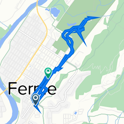
TCT Sectional/ Fernie to Sparwood
A cycling route starting in Fernie, British Columbia, Canada.
Overview
About this route
This route currently uses the Fernie River Trail System them paved roads and Highway 3 into Sparwood. Look for alternative offroad routes that Trails BC will post here that are accessible to the general public.
For more information on this segment refer to Bruce Obee's book The Trans Canada Trail the Baynes Lake to Sparwood section pages 321-323 <div><br /></div>
- -:--
- Duration
- 30.7 km
- Distance
- 220 m
- Ascent
- 81 m
- Descent
- ---
- Avg. speed
- ---
- Avg. speed

Route quality
Waytypes & surfaces along the route
Waytypes
Cycleway
17.5 km
(57 %)
Quiet road
7.8 km
(25 %)
Surfaces
Paved
4.8 km
(16 %)
Unpaved
0 km
(<1 %)
Asphalt
4.8 km
(16 %)
Unpaved (undefined)
0 km
(<1 %)
Undefined
25.9 km
(84 %)
Continue with Bikemap
Use, edit, or download this cycling route
You would like to ride TCT Sectional/ Fernie to Sparwood or customize it for your own trip? Here is what you can do with this Bikemap route:
Free features
- Save this route as favorite or in collections
- Copy & plan your own version of this route
- Sync your route with Garmin or Wahoo
Premium features
Free trial for 3 days, or one-time payment. More about Bikemap Premium.
- Navigate this route on iOS & Android
- Export a GPX / KML file of this route
- Create your custom printout (try it for free)
- Download this route for offline navigation
Discover more Premium features.
Get Bikemap PremiumFrom our community
Other popular routes starting in Fernie
 Canada Day 17: Fernie to Cranbrook
- Distance
- 97.1 km
- Ascent
- 386 m
- Descent
- 461 m
- Location
- Fernie, British Columbia, Canada
 Fernie to Gray Creek
- Distance
- 209.8 km
- Ascent
- 2,042 m
- Descent
- 2,467 m
- Location
- Fernie, British Columbia, Canada
 Highline 100k route, Fernie's Century Raod Ride
- Distance
- 97.2 km
- Ascent
- 627 m
- Descent
- 933 m
- Location
- Fernie, British Columbia, Canada
 Glacier-Waterton Loop D3
- Distance
- 68.7 km
- Ascent
- 622 m
- Descent
- 265 m
- Location
- Fernie, British Columbia, Canada
 341 First Ave, Fernie to 802 Second Ave, Fernie
- Distance
- 6.7 km
- Ascent
- 1,293 m
- Descent
- 1,293 m
- Location
- Fernie, British Columbia, Canada
 Broadwood loop
- Distance
- 76.7 km
- Ascent
- 705 m
- Descent
- 705 m
- Location
- Fernie, British Columbia, Canada
 Fernie to Gray Creek
- Distance
- 198.7 km
- Ascent
- 1,630 m
- Descent
- 2,055 m
- Location
- Fernie, British Columbia, Canada
 Fernie-Cranbrook
- Distance
- 106.1 km
- Ascent
- 399 m
- Descent
- 496 m
- Location
- Fernie, British Columbia, Canada
Open it in the app