

TCT Alternative Route Fernie to Sparwood
A cycling route starting in Fernie, British Columbia, Canada.
Overview
About this route
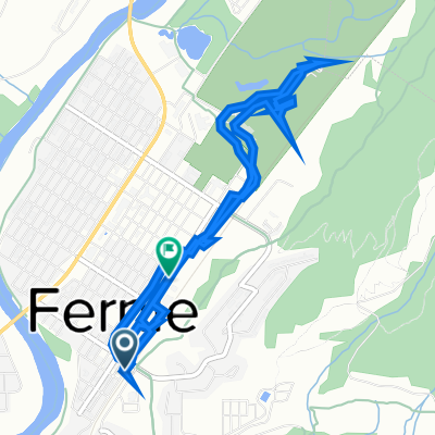
This Route utilizes for the most part the powerline road that forms the backbone of the Coal Discovery Trail. The Coal Discovery Trail weaves in and out alongside the PWL Road. The CDT itself is well signed. Fernie to Hosmer to is quite hilly(not recommended for loaded cyclists) but flattens out after Hosmer. North of Hosmer the land is managed by the Nature Conservancy of Canada who may at times restrict public access to this route.
For more information on this segment refer to Bruce Obee's official guide book -The Trans Canada Trail-BC the Baynes Lake to Sparwood section pages 325,322,323
book mileage start-52.9 km 2nd Highway 3 Bridge
book mileage end-80.9 entrance to Mountain Shadows Campground
- -:--
- Duration
- 29.5 km
- Distance
- 465 m
- Ascent
- 351 m
- Descent
- ---
- Avg. speed
- ---
- Avg. speed

Continue with Bikemap
Use, edit, or download this cycling route
You would like to ride TCT Alternative Route Fernie to Sparwood or customize it for your own trip? Here is what you can do with this Bikemap route:
Free features
- Save this route as favorite or in collections
- Copy & plan your own version of this route
- Sync your route with Garmin or Wahoo
Premium features
Free trial for 3 days, or one-time payment. More about Bikemap Premium.
- Navigate this route on iOS & Android
- Export a GPX / KML file of this route
- Create your custom printout (try it for free)
- Download this route for offline navigation
Discover more Premium features.
Get Bikemap PremiumFrom our community
Other popular routes starting in Fernie
 Fernie to Gray Creek
- Distance
- 209.8 km
- Ascent
- 2,042 m
- Descent
- 2,467 m
- Location
- Fernie, British Columbia, Canada
 341 First Ave, Fernie to 802 Second Ave, Fernie
- Distance
- 6.7 km
- Ascent
- 1,293 m
- Descent
- 1,293 m
- Location
- Fernie, British Columbia, Canada
 airport via Bull River and Kimberley
- Distance
- 159.8 km
- Ascent
- 1,123 m
- Descent
- 1,171 m
- Location
- Fernie, British Columbia, Canada
 Fernie to Gray Creek
- Distance
- 198.7 km
- Ascent
- 1,630 m
- Descent
- 2,055 m
- Location
- Fernie, British Columbia, Canada
 Highline 100k route, Fernie's Century Raod Ride
- Distance
- 97.2 km
- Ascent
- 627 m
- Descent
- 933 m
- Location
- Fernie, British Columbia, Canada
 Fernie Cycling
- Distance
- 19.5 km
- Ascent
- 461 m
- Descent
- 434 m
- Location
- Fernie, British Columbia, Canada
 Canada Day 17: Fernie to Cranbrook
- Distance
- 97.1 km
- Ascent
- 386 m
- Descent
- 461 m
- Location
- Fernie, British Columbia, Canada
 Glacier-Waterton Loop D3
- Distance
- 68.7 km
- Ascent
- 622 m
- Descent
- 265 m
- Location
- Fernie, British Columbia, Canada
Open it in the app