

Radwegenetz Bad Steben, Naila, Schwarzenbach W
A cycling route starting in Schlegel, Free State of Thuringia, Germany.
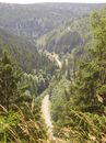
Overview
About this route
Die Radwege Langenbach - Bad Steben, Bad Steben - Marxgrün, Marxgrün - Thierbach, durch das Froschbachtal, Naila - Schwarzenbach / Wald zu einer Rundfahrt verbunden.
- -:--
- Duration
- 39.4 km
- Distance
- 478 m
- Ascent
- 478 m
- Descent
- ---
- Avg. speed
- ---
- Avg. speed
Route quality
Waytypes & surfaces along the route
Waytypes
Track
9.6 km
(24 %)
Cycleway
7.3 km
(19 %)
Surfaces
Paved
22.5 km
(57 %)
Unpaved
10.5 km
(27 %)
Asphalt
22.5 km
(57 %)
Loose gravel
5 km
(13 %)
Continue with Bikemap
Use, edit, or download this cycling route
You would like to ride Radwegenetz Bad Steben, Naila, Schwarzenbach W or customize it for your own trip? Here is what you can do with this Bikemap route:
Free features
- Save this route as favorite or in collections
- Copy & plan your own version of this route
- Sync your route with Garmin or Wahoo
Premium features
Free trial for 3 days, or one-time payment. More about Bikemap Premium.
- Navigate this route on iOS & Android
- Export a GPX / KML file of this route
- Create your custom printout (try it for free)
- Download this route for offline navigation
Discover more Premium features.
Get Bikemap PremiumFrom our community
Other popular routes starting in Schlegel
 Schlegel-Mödlareuth
- Distance
- 26.5 km
- Ascent
- 557 m
- Descent
- 641 m
- Location
- Schlegel, Free State of Thuringia, Germany
 Schwarzenbach-Steinbach-Bad Steben
- Distance
- 39.4 km
- Ascent
- 456 m
- Descent
- 456 m
- Location
- Schlegel, Free State of Thuringia, Germany
 Zentrale Frankenwaldtour
- Distance
- 50.8 km
- Ascent
- 535 m
- Descent
- 535 m
- Location
- Schlegel, Free State of Thuringia, Germany
 Radwegenetz Bad Steben, Naila, Schwarzenbach W
- Distance
- 39.4 km
- Ascent
- 478 m
- Descent
- 478 m
- Location
- Schlegel, Free State of Thuringia, Germany
 Auf den Spuren der Flöser
- Distance
- 22.5 km
- Ascent
- 454 m
- Descent
- 450 m
- Location
- Schlegel, Free State of Thuringia, Germany
 Sieglitzberg Lobenstein
- Distance
- 40.6 km
- Ascent
- 458 m
- Descent
- 742 m
- Location
- Schlegel, Free State of Thuringia, Germany
 Die Langenbacher Runde
- Distance
- 35.9 km
- Ascent
- 596 m
- Descent
- 596 m
- Location
- Schlegel, Free State of Thuringia, Germany
 EuroVelo 13 - Iron Curtain Trail - part 10
- Distance
- 43.3 km
- Ascent
- 809 m
- Descent
- 733 m
- Location
- Schlegel, Free State of Thuringia, Germany
Open it in the app