

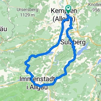
Allgäu - Kempten Lindau (2Tg)
A cycling route starting in Kempten (Allgäu), Bavaria, Germany.
Overview
About this route
Uns erwartet eine Radtour durch die Allgäuer Voralpenlandschaft über Oberstaufen bis nach Lindau. Wir tangieren das Zentrum des Naturparks Nagelfluhkette mit dem Hochgrat als höchster Erhebung. Weiter geht’s über die Grenze nach Österreich und schließlich nach Lindau, dem Ziel der Tour. (Tourbeschreibung unter: thod_er@gmx.de)
- -:--
- Duration
- 106.8 km
- Distance
- 1,400 m
- Ascent
- 1,703 m
- Descent
- ---
- Avg. speed
- ---
- Avg. speed
Route quality
Waytypes & surfaces along the route
Waytypes
Quiet road
40.6 km
(38 %)
Track
16.6 km
(16 %)
Surfaces
Paved
82.5 km
(77 %)
Unpaved
15.7 km
(15 %)
Asphalt
82.1 km
(77 %)
Gravel
12.7 km
(12 %)
Continue with Bikemap
Use, edit, or download this cycling route
You would like to ride Allgäu - Kempten Lindau (2Tg) or customize it for your own trip? Here is what you can do with this Bikemap route:
Free features
- Save this route as favorite or in collections
- Copy & plan your own version of this route
- Sync your route with Garmin or Wahoo
Premium features
Free trial for 3 days, or one-time payment. More about Bikemap Premium.
- Navigate this route on iOS & Android
- Export a GPX / KML file of this route
- Create your custom printout (try it for free)
- Download this route for offline navigation
Discover more Premium features.
Get Bikemap PremiumFrom our community
Other popular routes starting in Kempten (Allgäu)
 diepolz rettenberg
- Distance
- 62.6 km
- Ascent
- 689 m
- Descent
- 690 m
- Location
- Kempten (Allgäu), Bavaria, Germany
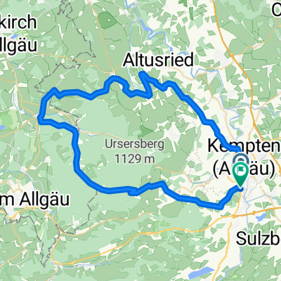 Nord-West Runde Kempten
- Distance
- 59.3 km
- Ascent
- 656 m
- Descent
- 664 m
- Location
- Kempten (Allgäu), Bavaria, Germany
 Von Kempten über Hauchenberg Niedersonthofen nach Kempten
- Distance
- 55.8 km
- Ascent
- 882 m
- Descent
- 872 m
- Location
- Kempten (Allgäu), Bavaria, Germany
 Alpencross III - Passo dello Stelvio
- Distance
- 428.2 km
- Ascent
- 3,410 m
- Descent
- 3,858 m
- Location
- Kempten (Allgäu), Bavaria, Germany
 Kempten-Jochpaß-Grän-Pfronten-Kempten
- Distance
- 106.7 km
- Ascent
- 1,185 m
- Descent
- 1,070 m
- Location
- Kempten (Allgäu), Bavaria, Germany
 Sonntags-Katertour
- Distance
- 53.7 km
- Ascent
- 1,107 m
- Descent
- 1,107 m
- Location
- Kempten (Allgäu), Bavaria, Germany
 Kempten-Oberstdorf
- Distance
- 50.8 km
- Ascent
- 460 m
- Descent
- 338 m
- Location
- Kempten (Allgäu), Bavaria, Germany
 Rund um Kempten
- Distance
- 18.4 km
- Ascent
- 143 m
- Descent
- 146 m
- Location
- Kempten (Allgäu), Bavaria, Germany
Open it in the app