

Ruta constante en Madrid
A cycling route starting in Puente de Vallecas, Madrid, Spain.
Overview
About this route
- 3 h 14 min
- Duration
- 44.9 km
- Distance
- 627 m
- Ascent
- 627 m
- Descent
- 13.9 km/h
- Avg. speed
- ---
- Avg. speed

Continue with Bikemap
Use, edit, or download this cycling route
You would like to ride Ruta constante en Madrid or customize it for your own trip? Here is what you can do with this Bikemap route:
Free features
- Save this route as favorite or in collections
- Copy & plan your own version of this route
- Sync your route with Garmin or Wahoo
Premium features
Free trial for 3 days, or one-time payment. More about Bikemap Premium.
- Navigate this route on iOS & Android
- Export a GPX / KML file of this route
- Create your custom printout (try it for free)
- Download this route for offline navigation
Discover more Premium features.
Get Bikemap PremiumFrom our community
Other popular routes starting in Puente de Vallecas
 Piscis day
- Distance
- 37.5 km
- Ascent
- 0 m
- Descent
- 0 m
- Location
- Puente de Vallecas, Madrid, Spain
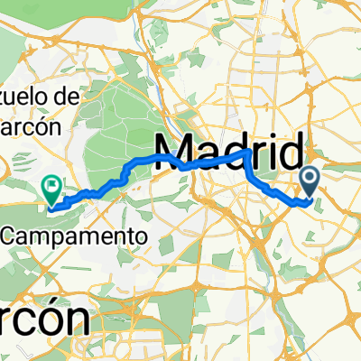 De Calle Alto del León 2, Madrid a Calle Virgilio 25A, Pozuelo de Alarcón
- Distance
- 15.9 km
- Ascent
- 200 m
- Descent
- 149 m
- Location
- Puente de Vallecas, Madrid, Spain
 Ruta San Martín de la Vega
- Distance
- 27.6 km
- Ascent
- 90 m
- Descent
- 181 m
- Location
- Puente de Vallecas, Madrid, Spain
 El Pardo
- Distance
- 47.5 km
- Ascent
- 405 m
- Descent
- 408 m
- Location
- Puente de Vallecas, Madrid, Spain
 Monte Urgull-Mar Caspio
- Distance
- 10.7 km
- Ascent
- 150 m
- Descent
- 57 m
- Location
- Puente de Vallecas, Madrid, Spain
 Parques del Sur
- Distance
- 30.3 km
- Ascent
- 213 m
- Descent
- 232 m
- Location
- Puente de Vallecas, Madrid, Spain
 Colmenar de Oreja
- Distance
- 126.9 km
- Ascent
- 825 m
- Descent
- 825 m
- Location
- Puente de Vallecas, Madrid, Spain
 Vallecas a parque Juan Carlos I
- Distance
- 34.6 km
- Ascent
- 186 m
- Descent
- 185 m
- Location
- Puente de Vallecas, Madrid, Spain
Open it in the app