

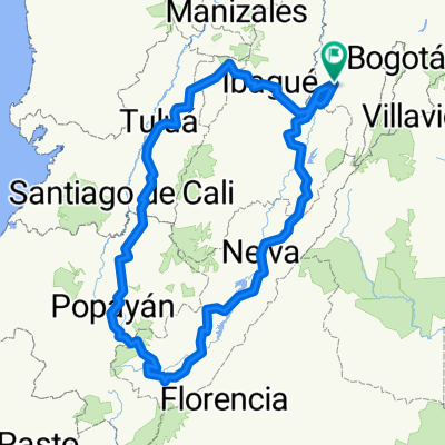
La Ruta De Los Nevados
A cycling route starting in Tocaima, Cundinamarca, Colombia.
Overview
About this route
Tocaima - Alto De Letras - Murillo - Líbano - Tocaima
- -:--
- Duration
- 423.6 km
- Distance
- 5,474 m
- Ascent
- 5,473 m
- Descent
- ---
- Avg. speed
- ---
- Avg. speed

Route quality
Waytypes & surfaces along the route
Waytypes
Busy road
128.6 km
(30 %)
Quiet road
118.2 km
(28 %)
Surfaces
Paved
143.4 km
(34 %)
Unpaved
108.4 km
(26 %)
Asphalt
87.5 km
(21 %)
Unpaved (undefined)
65.3 km
(15 %)
Continue with Bikemap
Use, edit, or download this cycling route
You would like to ride La Ruta De Los Nevados or customize it for your own trip? Here is what you can do with this Bikemap route:
Free features
- Save this route as favorite or in collections
- Copy & plan your own version of this route
- Sync your route with Garmin or Wahoo
Premium features
Free trial for 3 days, or one-time payment. More about Bikemap Premium.
- Navigate this route on iOS & Android
- Export a GPX / KML file of this route
- Create your custom printout (try it for free)
- Download this route for offline navigation
Discover more Premium features.
Get Bikemap PremiumFrom our community
Other popular routes starting in Tocaima
 Tocaima, Girardot, Flandes, Doble Calzada, Guataquisito, Guataqui, Jerusalén y Tocaima
- Distance
- 105.9 km
- Ascent
- 545 m
- Descent
- 543 m
- Location
- Tocaima, Cundinamarca, Colombia
 Tocaima - Ibagué - Cajamarca
- Distance
- 141 km
- Ascent
- 1,856 m
- Descent
- 434 m
- Location
- Tocaima, Cundinamarca, Colombia
 La Ruta De Los Nevados
- Distance
- 423.6 km
- Ascent
- 5,474 m
- Descent
- 5,473 m
- Location
- Tocaima, Cundinamarca, Colombia
 Tocaima - Honda - Tocaima
- Distance
- 249.9 km
- Ascent
- 817 m
- Descent
- 815 m
- Location
- Tocaima, Cundinamarca, Colombia
 Tocaima - Girardot - Prado - Girardot - Tocaima
- Distance
- 216.1 km
- Ascent
- 226 m
- Descent
- 226 m
- Location
- Tocaima, Cundinamarca, Colombia
 Tocaima - Viotá - Mesitas - La Mesa - Anapoima - Apulo - Tocaima
- Distance
- 88.5 km
- Ascent
- 1,378 m
- Descent
- 1,378 m
- Location
- Tocaima, Cundinamarca, Colombia
 Ruta De Entrenamiento #1
- Distance
- 116.2 km
- Ascent
- 621 m
- Descent
- 620 m
- Location
- Tocaima, Cundinamarca, Colombia
 La Ruta Precolombina
- Distance
- 1,291.9 km
- Ascent
- 7,630 m
- Descent
- 7,629 m
- Location
- Tocaima, Cundinamarca, Colombia
Open it in the app