

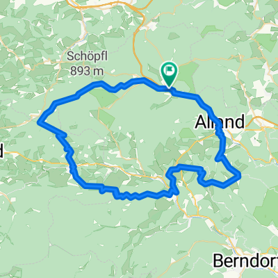
WIENERWALDSEE - TOUR
A cycling route starting in Klausen-Leopoldsdorf, Lower Austria, Austria.
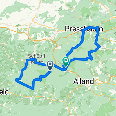
Overview
About this route
Quelle: Radatlas Wienerwald 7 A,B
Start und Ziel: Klausen-Leopoldsdorf
- -:--
- Duration
- 36.6 km
- Distance
- 562 m
- Ascent
- 559 m
- Descent
- ---
- Avg. speed
- ---
- Avg. speed

Route quality
Waytypes & surfaces along the route
Waytypes
Busy road
16.4 km
(45 %)
Road
16 km
(44 %)
Surfaces
Paved
35.3 km
(96 %)
Unpaved
0.3 km
(<1 %)
Asphalt
35.3 km
(96 %)
Gravel
0.3 km
(<1 %)
Undefined
1 km
(3 %)
Continue with Bikemap
Use, edit, or download this cycling route
You would like to ride WIENERWALDSEE - TOUR or customize it for your own trip? Here is what you can do with this Bikemap route:
Free features
- Save this route as favorite or in collections
- Copy & plan your own version of this route
- Sync your route with Garmin or Wahoo
Premium features
Free trial for 3 days, or one-time payment. More about Bikemap Premium.
- Navigate this route on iOS & Android
- Export a GPX / KML file of this route
- Create your custom printout (try it for free)
- Download this route for offline navigation
Discover more Premium features.
Get Bikemap PremiumFrom our community
Other popular routes starting in Klausen-Leopoldsdorf
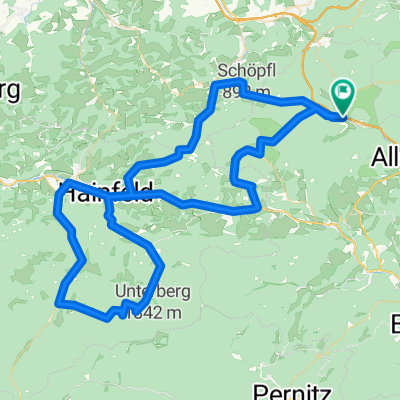 Klausen-Leopoldsdorf-Hainburg-Ramsau
- Distance
- 89.5 km
- Ascent
- 1,065 m
- Descent
- 1,065 m
- Location
- Klausen-Leopoldsdorf, Lower Austria, Austria
 WIENERWALDSEE - TOUR
- Distance
- 36.6 km
- Ascent
- 562 m
- Descent
- 559 m
- Location
- Klausen-Leopoldsdorf, Lower Austria, Austria
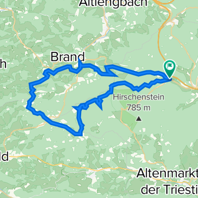
 KlausenLeo - Schöpfl - Hocheck - Peilstein - Alland - KlausenLeo
- Distance
- 59.8 km
- Ascent
- 1,624 m
- Descent
- 1,624 m
- Location
- Klausen-Leopoldsdorf, Lower Austria, Austria
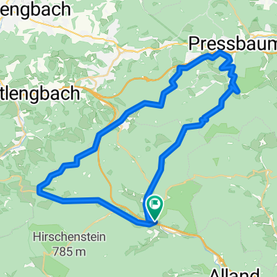
 SCHÖPFEL - KLAMMHÖHE
- Distance
- 36.2 km
- Ascent
- 1,015 m
- Descent
- 1,015 m
- Location
- Klausen-Leopoldsdorf, Lower Austria, Austria
 Klammhöhe
- Distance
- 37.6 km
- Ascent
- 0 m
- Descent
- 0 m
- Location
- Klausen-Leopoldsdorf, Lower Austria, Austria
 Pfalzberg Strecke
- Distance
- 38.9 km
- Ascent
- 619 m
- Descent
- 618 m
- Location
- Klausen-Leopoldsdorf, Lower Austria, Austria
 Mariazell-RSC
- Distance
- 195.8 km
- Ascent
- 1,612 m
- Descent
- 1,602 m
- Location
- Klausen-Leopoldsdorf, Lower Austria, Austria
 Schöpfel, Hengstl, Kleiner Semmering
- Distance
- 73.1 km
- Ascent
- 994 m
- Descent
- 1,106 m
- Location
- Klausen-Leopoldsdorf, Lower Austria, Austria
Open it in the app