

Woodhead Line
A cycling route starting in Sheffield, England, United Kingdom.
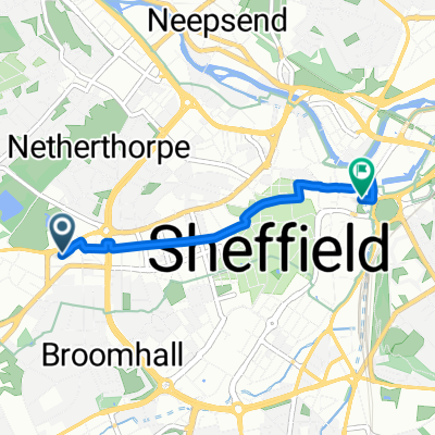
Overview
About this route
Sheffield to Manchester on the old Woodhead Line railway
- -:--
- Duration
- 73.4 km
- Distance
- 504 m
- Ascent
- 506 m
- Descent
- ---
- Avg. speed
- ---
- Avg. speed

Route quality
Waytypes & surfaces along the route
Waytypes
Quiet road
24.2 km
(33 %)
Cycleway
18 km
(25 %)
Surfaces
Paved
25.1 km
(34 %)
Unpaved
7.6 km
(10 %)
Asphalt
20.5 km
(28 %)
Gravel
6.5 km
(9 %)
Continue with Bikemap
Use, edit, or download this cycling route
You would like to ride Woodhead Line or customize it for your own trip? Here is what you can do with this Bikemap route:
Free features
- Save this route as favorite or in collections
- Copy & plan your own version of this route
- Sync your route with Garmin or Wahoo
Premium features
Free trial for 3 days, or one-time payment. More about Bikemap Premium.
- Navigate this route on iOS & Android
- Export a GPX / KML file of this route
- Create your custom printout (try it for free)
- Download this route for offline navigation
Discover more Premium features.
Get Bikemap PremiumFrom our community
Other popular routes starting in Sheffield
 Brad field- Bamford loop
- Distance
- 41 km
- Ascent
- 0 m
- Descent
- 0 m
- Location
- Sheffield, England, United Kingdom
 Octagon Centre Sheffield
- Distance
- 2.2 km
- Ascent
- 66 m
- Descent
- 4 m
- Location
- Sheffield, England, United Kingdom
 Sheffield to Hathersage Loop via Ringinglow
- Distance
- 29 km
- Ascent
- 811 m
- Descent
- 810 m
- Location
- Sheffield, England, United Kingdom
 Urban Dash
- Distance
- 15.7 km
- Ascent
- 180 m
- Descent
- 183 m
- Location
- Sheffield, England, United Kingdom
 Octagon Centre Sheffield Return
- Distance
- 2.2 km
- Ascent
- 0 m
- Descent
- 62 m
- Location
- Sheffield, England, United Kingdom
 Meadowhall round trip via Cobweb Bridge
- Distance
- 20.2 km
- Ascent
- 57 m
- Descent
- 118 m
- Location
- Sheffield, England, United Kingdom
 Sheffield to Hadfield Low Traffic Gravel
- Distance
- 61.9 km
- Ascent
- 548 m
- Descent
- 428 m
- Location
- Sheffield, England, United Kingdom
 Stannington to Dam Flask &Ughill
- Distance
- 19.9 km
- Ascent
- 309 m
- Descent
- 404 m
- Location
- Sheffield, England, United Kingdom
Open it in the app