

Ruta tranquila en Benito Juárez
A cycling route starting in Cancún, Quintana Roo, Mexico.
Overview
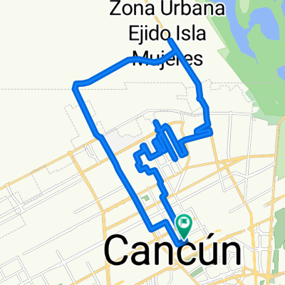
About this route
- 23 min
- Duration
- 4.8 km
- Distance
- 0 m
- Ascent
- 5 m
- Descent
- 12.6 km/h
- Avg. speed
- ---
- Avg. speed
Continue with Bikemap
Use, edit, or download this cycling route
You would like to ride Ruta tranquila en Benito Juárez or customize it for your own trip? Here is what you can do with this Bikemap route:
Free features
- Save this route as favorite or in collections
- Copy & plan your own version of this route
- Sync your route with Garmin or Wahoo
Premium features
Free trial for 3 days, or one-time payment. More about Bikemap Premium.
- Navigate this route on iOS & Android
- Export a GPX / KML file of this route
- Create your custom printout (try it for free)
- Download this route for offline navigation
Discover more Premium features.
Get Bikemap PremiumFrom our community
Other popular routes starting in Cancún
 cancun r2
- Distance
- 31.9 km
- Ascent
- 1,242 m
- Descent
- 1,246 m
- Location
- Cancún, Quintana Roo, Mexico
 Saison 4 - Mexique
- Distance
- 1,914.4 km
- Ascent
- 508 m
- Descent
- 503 m
- Location
- Cancún, Quintana Roo, Mexico
 nocturna con Max cargamos
- Distance
- 31.2 km
- Ascent
- 13 m
- Descent
- 17 m
- Location
- Cancún, Quintana Roo, Mexico
 Cancun to Tikal
- Distance
- 759.7 km
- Ascent
- 570 m
- Descent
- 335 m
- Location
- Cancún, Quintana Roo, Mexico
 Toni´s Reise
- Distance
- 9,213.2 km
- Ascent
- 9,446 m
- Descent
- 7,677 m
- Location
- Cancún, Quintana Roo, Mexico
 Portillo Torito Rancho Viejo Villas del Mar
- Distance
- 27.5 km
- Ascent
- 9 m
- Descent
- 8 m
- Location
- Cancún, Quintana Roo, Mexico
 De Calle Paseo el Peral 53, Cancún a Avenida Las Torres 26, Cancún
- Distance
- 12.2 km
- Ascent
- 0 m
- Descent
- 4 m
- Location
- Cancún, Quintana Roo, Mexico
 De Calle Much 65, Cancún a Boulevard Kukulcan 18, Cancún
- Distance
- 22.7 km
- Ascent
- 37 m
- Descent
- 38 m
- Location
- Cancún, Quintana Roo, Mexico
Open it in the app