
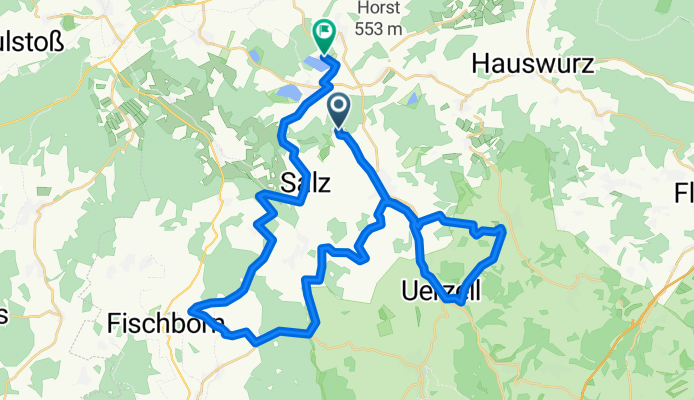
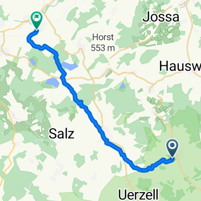
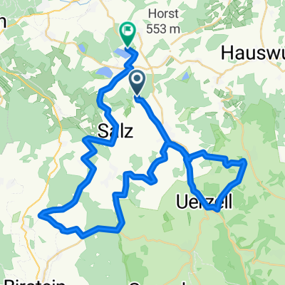
Seenroute/südl. VB-Radweg
A cycling route starting in Freiensteinau, Hesse, Germany.
Overview
About this route
Alternativroute zur VB-Seenroute über Freienateinau/Hintersteinau Ri Birstein auf den Südradweg. Bis auf den Anfang auf geteerten Landwi.-Wegen, ruhigen Landstraßen und Radwegen. Teils kurze, aber heftige Abfahrten und Anstiege durch Dörfer, die man sonst nicht mitbekommt.
- -:--
- Duration
- 42.9 km
- Distance
- 526 m
- Ascent
- 519 m
- Descent
- ---
- Avg. speed
- ---
- Avg. speed

Route quality
Waytypes & surfaces along the route
Waytypes
Track
16 km
(37 %)
Road
13.9 km
(33 %)
Surfaces
Paved
30.7 km
(72 %)
Unpaved
1.9 km
(4 %)
Asphalt
30.6 km
(71 %)
Gravel
1.7 km
(4 %)
Continue with Bikemap
Use, edit, or download this cycling route
You would like to ride Seenroute/südl. VB-Radweg or customize it for your own trip? Here is what you can do with this Bikemap route:
Free features
- Save this route as favorite or in collections
- Copy & plan your own version of this route
- Sync your route with Garmin or Wahoo
Premium features
Free trial for 3 days, or one-time payment. More about Bikemap Premium.
- Navigate this route on iOS & Android
- Export a GPX / KML file of this route
- Create your custom printout (try it for free)
- Download this route for offline navigation
Discover more Premium features.
Get Bikemap PremiumFrom our community
Other popular routes starting in Freiensteinau
 SGF-Radtoour
- Distance
- 57.9 km
- Ascent
- 473 m
- Descent
- 731 m
- Location
- Freiensteinau, Hesse, Germany
 Rhönrunde
- Distance
- 446.6 km
- Ascent
- 3,831 m
- Descent
- 3,828 m
- Location
- Freiensteinau, Hesse, Germany
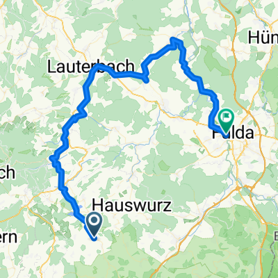 2.Etappe Freiensteinau - Fulda
- Distance
- 72.1 km
- Ascent
- 405 m
- Descent
- 586 m
- Location
- Freiensteinau, Hesse, Germany
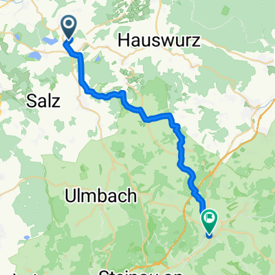 Von Niedermoos nach Schlüchtern
- Distance
- 22.7 km
- Ascent
- 285 m
- Descent
- 572 m
- Location
- Freiensteinau, Hesse, Germany
 Seen-Tour
- Distance
- 15.3 km
- Ascent
- 289 m
- Descent
- 198 m
- Location
- Freiensteinau, Hesse, Germany
 Seenroute/südl. VB-Radweg
- Distance
- 42.9 km
- Ascent
- 526 m
- Descent
- 519 m
- Location
- Freiensteinau, Hesse, Germany
 Bergwinkel-Giro 2020 159 km-Strecke ab Ulmbach bis zum Ziel Steinau (nur Landstraße)
- Distance
- 59.6 km
- Ascent
- 617 m
- Descent
- 822 m
- Location
- Freiensteinau, Hesse, Germany
 HRVM Alternative 3
- Distance
- 10.4 km
- Ascent
- 128 m
- Descent
- 128 m
- Location
- Freiensteinau, Hesse, Germany
Open it in the app