

Slow ride in Granby
A cycling route starting in Salmon Brook, Connecticut, United States of America.
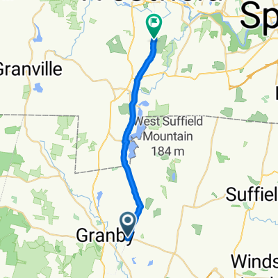
Overview
About this route
- 57 min
- Duration
- 18.2 km
- Distance
- 329 m
- Ascent
- 325 m
- Descent
- 19.2 km/h
- Avg. speed
- ---
- Avg. speed
Route quality
Waytypes & surfaces along the route
Waytypes
Cycleway
13.3 km
(73 %)
Busy road
2 km
(11 %)
Surfaces
Paved
14.3 km
(79 %)
Paved (undefined)
13.2 km
(72 %)
Asphalt
1 km
(5 %)
Continue with Bikemap
Use, edit, or download this cycling route
You would like to ride Slow ride in Granby or customize it for your own trip? Here is what you can do with this Bikemap route:
Free features
- Save this route as favorite or in collections
- Copy & plan your own version of this route
- Sync your route with Garmin or Wahoo
Premium features
Free trial for 3 days, or one-time payment. More about Bikemap Premium.
- Navigate this route on iOS & Android
- Export a GPX / KML file of this route
- Create your custom printout (try it for free)
- Download this route for offline navigation
Discover more Premium features.
Get Bikemap PremiumFrom our community
Other popular routes starting in Salmon Brook
 Granby to 10 Metacomet Dr, East Granby
- Distance
- 6.6 km
- Ascent
- 106 m
- Descent
- 80 m
- Location
- Salmon Brook, Connecticut, United States of America
 Granby to Lake Congamond
- Distance
- 23.2 km
- Ascent
- 83 m
- Descent
- 86 m
- Location
- Salmon Brook, Connecticut, United States of America
 Unnamed Road, Granby to Bancroft Road 84, Northampton
- Distance
- 44.3 km
- Ascent
- 381 m
- Descent
- 368 m
- Location
- Salmon Brook, Connecticut, United States of America
 Old Newgate Prison to Westfield
- Distance
- 19.6 km
- Ascent
- 179 m
- Descent
- 270 m
- Location
- Salmon Brook, Connecticut, United States of America
 Turkey Hills Road to East Granby Road
- Distance
- 63 km
- Ascent
- 630 m
- Descent
- 622 m
- Location
- Salmon Brook, Connecticut, United States of America
 Recovered Route
- Distance
- 58.6 km
- Ascent
- 105 m
- Descent
- 101 m
- Location
- Salmon Brook, Connecticut, United States of America
 east granby turkey hills bike path to westfield
- Distance
- 49.5 km
- Ascent
- 296 m
- Descent
- 298 m
- Location
- Salmon Brook, Connecticut, United States of America
 Recording from July 5, 12:10 PM
- Distance
- 17.4 km
- Ascent
- 92 m
- Descent
- 94 m
- Location
- Salmon Brook, Connecticut, United States of America
Open it in the app