

Amper-Paar-Radweg
A cycling route starting in Eresing, Bavaria, Germany.
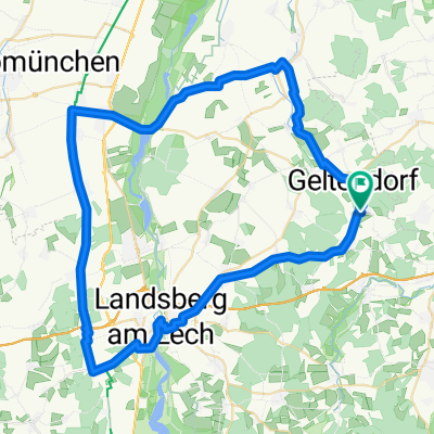
Overview
About this route
Der Amper-Paar-Radweg führt von Malching (bei Fürstenfeldbruck) nach Aichach. Die ländliche Route leitet über verkehrsarme asphaltierte Straßen und über beschauliche Rad-, Feld- und Waldwege. Dabei werden weite Felder und kleinere Waldstücke passiert. Das Gelände ist zu Beginn der Radtour recht flach; im Charakter ist das aber ein „Bergab“-Flußtal Radweg. Das relativiert dann auch die Gesamt-km von 68 km. (Tourbeschreibung unter: thod_er@gmx.de)
- -:--
- Duration
- 69.6 km
- Distance
- 525 m
- Ascent
- 683 m
- Descent
- ---
- Avg. speed
- ---
- Avg. speed
Route quality
Waytypes & surfaces along the route
Waytypes
Quiet road
26.9 km
(39 %)
Path
14.9 km
(21 %)
Surfaces
Paved
43.8 km
(63 %)
Unpaved
15.6 km
(22 %)
Asphalt
41.4 km
(59 %)
Gravel
12 km
(17 %)
Continue with Bikemap
Use, edit, or download this cycling route
You would like to ride Amper-Paar-Radweg or customize it for your own trip? Here is what you can do with this Bikemap route:
Free features
- Save this route as favorite or in collections
- Copy & plan your own version of this route
- Sync your route with Garmin or Wahoo
Premium features
Free trial for 3 days, or one-time payment. More about Bikemap Premium.
- Navigate this route on iOS & Android
- Export a GPX / KML file of this route
- Create your custom printout (try it for free)
- Download this route for offline navigation
Discover more Premium features.
Get Bikemap PremiumFrom our community
Other popular routes starting in Eresing
 13.09.10 Geltendorf-Oberstaufen
- Distance
- 4.4 km
- Ascent
- 54 m
- Descent
- 18 m
- Location
- Eresing, Bavaria, Germany
 Ammerseerunde Hauptstraße 31, Eresing nach Landsberger Straße 64, Inning am Ammersee
- Distance
- 50.9 km
- Ascent
- 240 m
- Descent
- 289 m
- Location
- Eresing, Bavaria, Germany
 Rennrad 67 km
- Distance
- 67.6 km
- Ascent
- 228 m
- Descent
- 228 m
- Location
- Eresing, Bavaria, Germany
 Geltendorf-Hurlach
- Distance
- 66.1 km
- Ascent
- 419 m
- Descent
- 421 m
- Location
- Eresing, Bavaria, Germany
 Geltendorf-Landsberg
- Distance
- 65.6 km
- Ascent
- 525 m
- Descent
- 524 m
- Location
- Eresing, Bavaria, Germany
 Geltendorf - Hechendorf
- Distance
- 19.3 km
- Ascent
- 151 m
- Descent
- 207 m
- Location
- Eresing, Bavaria, Germany
 Eresing - Hohenpeissenberg
- Distance
- 48.9 km
- Ascent
- 650 m
- Descent
- 276 m
- Location
- Eresing, Bavaria, Germany
 St Ottilien Ammersee
- Distance
- 61.6 km
- Ascent
- 311 m
- Descent
- 310 m
- Location
- Eresing, Bavaria, Germany
Open it in the app